
REVIEW · CANADA AUDIO TOURS
Icefields Parkway Self-Guided Driving Audio Tour
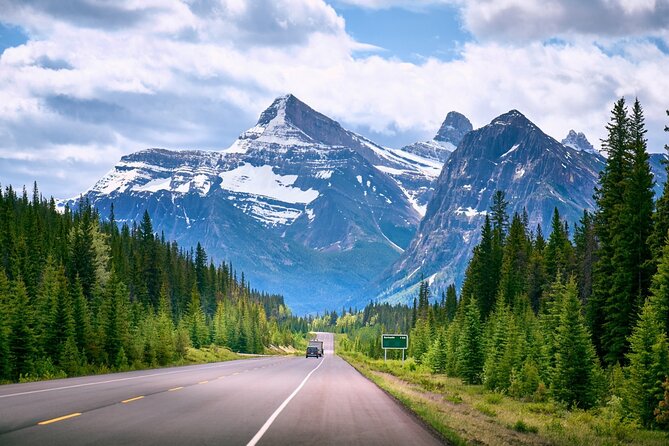
The best road trips need good timing. This self-guided Icefields Parkway tour turns a long drive between Jasper and Lake Louise into a story-filled journey, with more than 76 audio stops covering glaciers, waterfalls, mountain peaks, Indigenous guides, explorers, and the strange blue color of the lakes. I especially like the hands-free GPS playback and the freedom to stop for hikes, photos, lunch, or a quiet look at the mountains.
The price is another strong point: $16.99 per car group of up to four, rather than a fee for each person. The main drawback is the app setup. You must download a separate app, enter a password, and prepare the tour before leaving reliable Wi-Fi or cellular service. One person had trouble launching it on the first day, so I would treat setup as part of the trip planning.
Key points to know before you drive
- More than 140 miles of route: The full journey runs from Jasper toward Lake Louise, with about 76 audio stories and an advertised driving time of three to four hours.
- GPS-triggered narration: Stories begin automatically as you approach each point, so you can keep your eyes on the road.
- Excellent carload value: One purchase covers up to four people, making this far cheaper than a private guide or bus excursion.
- Useful hiking choices: The narration tells you where trails begin and gives rough distances and walking times for places such as Athabasca Falls, Parker Ridge, and Mistaya Canyon.
- Offline access matters: Download the tour in strong Wi-Fi or cellular service before reaching remote stretches of the parkway.
- A one-way route with an important version choice: This version begins in Jasper and ends near Lake Louise. A separate Lake Louise version is needed if you plan to drive the other direction.
What the Icefields Parkway audio tour actually does
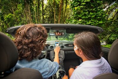
This is not a guided bus trip, and nobody meets you at a starting point. You drive your own vehicle, open Action’s Tour Guide app, and follow the route while the narration plays from your phone through Bluetooth, USB, or AUX.
The app uses your location to trigger each story. That means you can listen without handling the phone while driving. You can also pause the tour, skip a stop, begin from another point, or spread the journey across several days.
That flexibility is the real point. The Icefields Parkway is too good to rush, and the advertised three to four hours describes the driving and audio route, not a leisurely day with hikes and viewpoints. If you stop at several waterfalls, walk to a glacier, and take time at the lakes, plan on much longer.
Before you go, download the separate app, enter the password sent by email and text, and test it. The instructions say to search your messages for audio tour if the setup email is hard to find. Apple CarPlay is supported, while Android Auto support is still listed as forthcoming. An iPhone using iOS 15 or later, or an Android device using version 9 or later, is recommended.
More Driving Audio Tours in Canada
- Icefields Parkway: a Smartphone Audio Driving Tour
★ 4.0 · 118 reviews - Cabot Trail: a Smartphone Audio Driving Tour
★ 4.5 · 118 reviews - Smartphone Audio Driving Tour between Banff and Calgary
★ 4.0 · 25 reviews
Starting in Jasper: five lakes, cliffs, and waterfalls

The Jasper version begins with a reminder to choose the correct direction. This matters because the route also exists in a Lake Louise version, and the two are not interchangeable.
Near the beginning, the narration points out the Jasper SkyTram and tells the story of Whistler Mountain’s early skiers. In the 1940s, skiers gathered for the good slopes, but getting back uphill meant struggling with a simple tow rope. It is a small story, yet it helps explain how mountain recreation changed.
The first proper stop is the Valley of the Five Lakes Trailhead. The roughly three-mile loop takes about 90 minutes and passes five lakes with striking blue and turquoise water. The explanation connects the color to glacial material in the water, giving you a useful answer to the question you will ask all day: why are these lakes so blue?
Next comes Athabasca Pass Lookout, with a view toward the South Jasper Mountain Range and Mount Edith Cavell. The narration gives the peak’s height as 11,033 feet, a detail that helps you understand the scale of the mountains around the road.
At Horseshoe Lake, the story takes a more dramatic turn. The U-shaped lake has steep rock faces and is known for cliff jumping from a height of about 75 feet. The audio describes the adrenaline of the leap, but you should treat this as a story about the place, not an invitation to jump into freezing water.
Athabasca Falls is one of the key early stops. The falls drop about 75 feet into a canyon formed as glacial changes allowed the Athabasca River to cut through the rock. The viewpoint is close to the road, so it is a practical stop even if you are trying to keep moving.
The narration then identifies Mount Kerkeslin, the highest peak in the Maligne Range at 9,790 feet. At Goats and Glacier Lookout, watch the cliffs for mountain goats. The story explains that minerals, including salt, attract the animals to the rocks. Wildlife sightings are never guaranteed, but the lookout has a clear reason for its name.
Glaciers, old routes, and the Columbia Icefield
The next stretch links mountain names with the people who explored and mapped the area. You hear about Mount Christie, named by explorer James Hector for William Joseph Christie, and then reach Honeymoon Lake, where reflections of the Maligne Range may appear in the water. Canoes may be visible here, adding a gentle pause after the larger falls and peaks.
At Sunwapta Falls, an easy two-mile trail takes a little over an hour and leads to a waterfall fed by the Athabasca Glacier. The name Sunwapta comes from the Stoney-Nakoda word for turbulent water, which fits the force of the falls.
The audio then identifies Endless Chain Ridge, a jagged group of peaks formed from rock dating back roughly 200 million years. The story explains how pressure beneath the earth pushed the rock upward much later. It is a good example of the tour’s approach: you are not only told what you are seeing, but also given a basic explanation of how it came to be.
At Poboktan Creek, the trail parking area marks the start of a 24-mile route that usually takes four days. This is useful context for planning. Not every trail sign beside the parkway points to a casual walk, and the narration helps you tell the difference.
The section around Beauty Creek brings more water and ice. The creek is fed by glacial meltwater, and the route leads, farther into the wilderness, toward Stanley Falls and several cascades. In cold months, these waterfalls can turn into sheets of ice.
The Stutfield Glacier Viewpoint offers one of the more direct glacier views from the road. The glacier stretches about 3,000 feet across the cliff face, with double icefalls where the bed steepens and the ice speeds up. The narration also notes the crevasses, giving you a better sense of why glacial terrain is dangerous beyond the marked viewing areas.
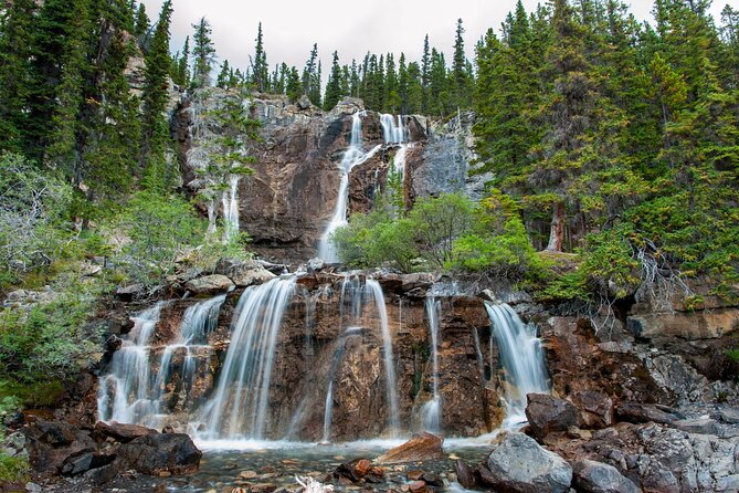
Tangle Creek Falls is hard to miss because the 90-foot cascade runs beside the parkway. The story introduces Mary Schäffer Warren, who named both Tangle Creek and Endless Chain Ridge, and Samson Beaver, a Stoney-Nakoda guide who accompanied her on many journeys. These details give human shape to a route that can otherwise feel like an endless parade of peaks.
The glacier highlights near the middle of the route
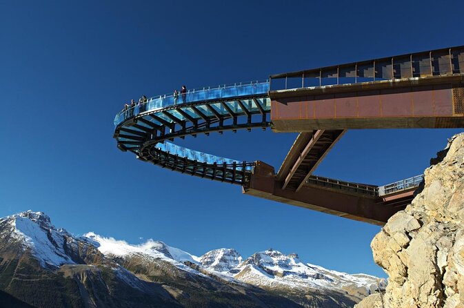
The Columbia Icefield section is where I would allow extra time. The audio points toward the Columbia Icefield Skywalk, a glass-floored walkway extending about 100 feet over the Sunwapta Valley, with the valley floor more than 900 feet below. Entrance is not included, so you need to arrange and pay for that separately if you want to visit.
Mount Kitchener rises to 11,499 feet and is named for British officer Horatio Kitchener, who died during the First World War. The story is brief but memorable, especially because the peak’s name connects a remote Canadian mountain with events far away.
At the Toe of the Athabasca Glacier Trailhead, a hike of a little over one mile brings you closer to the glacier. This is one of the most useful suggestions in the tour because it turns a distant white mass into a place you can approach on foot.
The Wilcox Pass Trail is listed as a challenging seven-mile hike, but you do not need to commit to the full route. Many people walk a little more than a mile to reach a viewpoint toward Mount Snow Dome, then return. The narration makes this sound more manageable for people who want a taste of high-country scenery without spending most of the day on a trail.
Parker Ridge requires about four miles of hiking and a little over two hours. In return, you get alpine meadows, views toward the Columbia Icefield, and a fresh angle on the blue lakes below. If your schedule allows only one longer walk in this section, the audio gives you enough information to decide if this is your choice.
The waterfall options continue at Panther Falls. The route to the 210-foot cascade is described as an easy 1.5-mile walk taking about 30 minutes, with an optional continuation to Bridal Veil Falls. The possibility of seeing two waterfalls from one stop is a good reason to keep this one on your list.
At the Weeping Wall, the cliffs rise about 900 feet. Water may trickle from springs at the top or run more visibly, depending on the season and conditions. You will not always see a dramatic waterfall, but the stop is still worth understanding because the name comes from this changing behavior.
More Self-Guided Audio Tours in Canada
- Self Guided Audio Driving Tour of the North Shore of PEI
★ 4.0 · 24 reviews - Self-Guided Audio Driving Tour in Icefields Parkway
★ 5.0 · 24 reviews - Self-Guided Audio Tours for the Canadian Rockies
★ 5.0 · 18 reviews - Discover the Rockies: 6 Self-Guided Smartphone Audio Tour Bundle
★ 4.0 · 10 reviews
Crossing into Banff and following the blue lakes
The route passes HI Rampart Creek Wilderness Hostel, a modest lodging option tied to the growth of tourism in the region. Then you reach Saskatchewan River Crossing, where the narration recalls an 1882 river crossing operated by John Walter with a plank platform, horse, and carriage.
At Howse River, pull into the viewpoint parking area for mountain and river views. This is an easy stop, useful after the glacier section and before the route turns toward Banff’s famous lakes.
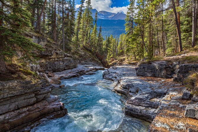
Mistaya Canyon offers a moderate 1.5-mile walk taking around 40 minutes. The trail leads toward a deep gorge carved by rushing water. The narration also introduces Mount Chephren, whose angular 10,715-foot summit first carried the name Pyramid Mountain before the park gave it the name of an Egyptian pharaoh.
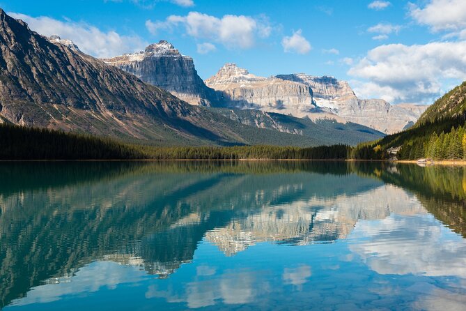
Waterfowl Lake is one of the easiest scenic stops because the lake sits close to the road. You can see its greenish water from the viewpoint without committing to a long walk. The audio adds a cultural detail about the lakes becoming popular gathering places during the counterculture movement of the 1960s.
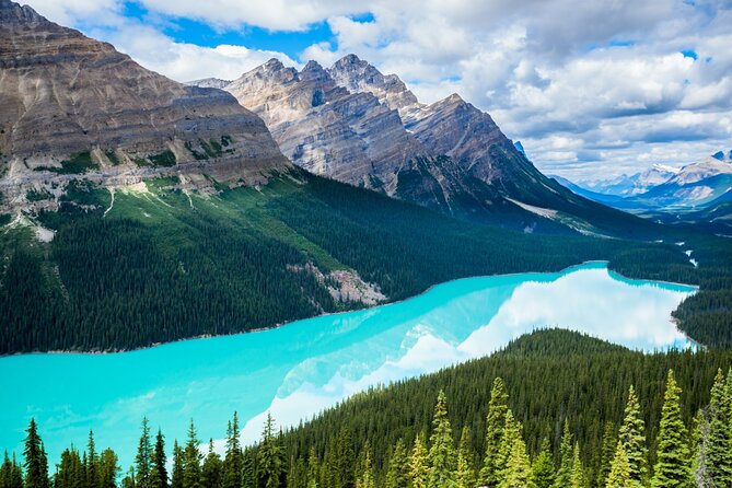
The Snowbird Glacier viewpoint shows a glacier flowing down Mount Patterson in a shape that can resemble outstretched wings. At Peyto Lake, the side road leads to an overlook above the bright turquoise water and a roughly two-mile trail around the lake. The viewpoint can be one of the busiest-feeling stops simply because the lake is so striking, but the tour’s narration gives you a reason to look beyond the photograph and notice its glacial source.
Bow Lake reflects Mount Jimmy Simpson and offers another strong roadside photo stop. At Crowfoot Glacier, you learn that the ice once had three lobes, shaped like a crow’s foot, but one has disappeared as the glacier receded.
The final stretch includes the Wapta Icefield and Hector Lake, positioned beneath Lilliput Mountain and Mount Balfour. At the end, continue for another five to ten minutes to reach Lake Louise.
Price, pacing, and the value of the app
At $16.99 for up to four people, this is good value if you are already driving the parkway. A carload of four pays only a few dollars each, and even a couple gets a narrated route for less than the cost of many organized sightseeing options.
The value comes less from the number of stops than from the decision help. You learn which trails take 30 minutes and which require four days, which viewpoints sit right beside the road, and which attractions need extra payment. That can save you from wasting time or missing a worthwhile short walk.
The main weakness is technical rather than scenic. The tour depends on your phone, GPS, downloaded data, and correct app setup. One useful workaround is to print the stop list before leaving. You can then see where you want to pause even if the audio takes time to start.
Who should book this Icefields Parkway tour?
I would recommend it to independent drivers who want context but do not want to join a fixed group. It also suits families, couples, and older people who value frequent breaks and a flexible schedule. The ability to pause at any time is particularly helpful for anyone who wants to combine viewpoints with easy walks.
I would think twice if you dislike apps or expect a person to answer questions beside you. The narration is recorded, and the tour does not include attraction tickets, reservations, or a live guide.
You also need to select the correct direction. The supplied meeting-point details list Lake Louise, but the route description for this version clearly says it begins in Jasper and ends at Lake Louise. Confirm that your planned drive matches the Jasper-to-Lake Louise version before setting out.
Should you book it?
Book it if you are driving from Jasper toward Lake Louise and want a low-cost narrator to point out the parkway’s major sights, trails, and stories. The strongest reasons are the hands-free playback, the ability to travel at your own speed, and the excellent per-car price.
Skip it if you want a fully guided outing or if app setup sounds like a chore. For everyone else, download it before departure, test the audio, print a backup stop list, and allow more than four hours if you plan to walk. That is the best way to get the value from this spectacular road.
FAQ
How much does the Icefields Parkway audio tour cost?
The tour costs $16.99 per group, covering up to four people in one vehicle.
How long does the tour take?
The narrated drive takes about three to four hours, but the full route is more than 140 miles. Additional time is needed for hikes, viewpoints, meals, and side excursions.
Where does this version of the tour begin?
This version begins in Jasper and travels toward Lake Louise. A separate version is available for starting near Lake Louise and driving the opposite direction.
Does anyone meet me at the starting point?
No. This is a private, self-guided activity, so you begin on your own using the Action Tour Guide app.
Do I need cellular or Wi-Fi service during the drive?
You need strong Wi-Fi or cellular service to download the tour before starting. Once downloaded, it works offline.
How does the audio begin?
Open the app at the starting point and enter the first story location. The audio should begin automatically and continue with location-triggered stories along the route.
Are attraction tickets included?
No. Attraction passes, entry tickets, and reservations are not included in the $16.99 price.
Can I pause the tour or use it on another day?
Yes. The tour has lifetime access with no expiry. You can pause it, resume it later, use it over multiple days, and take the tour again on future trips.
Just added around Canada
- Queen Street West: An audio tour exploring Toronto’s coolest street★ 3.5 · 2 reviews
- Toronto’s Waterfront: a Smartphone Audio Walking Tour★ 5.0 · 5 reviews
- St. John’s Audio Walking Tour★ 4.0 · 4 reviews
- Irish Loop Smartphone Audio Driving Tour★ 4.5 · 7 reviews
- Fruit alcohol tasting + Velvet Orchards audio tour★ 5.0 · 2 reviews
- APP Self-Guided Tours Quebec with Audioguide★ 3.0 · 2 reviews
- Quebec City Self-Guided Driving Audio Tour★ 4.0 · 7 reviews
- Smartphone Audio Driving Tour between Wasaga Beach and Toronto★ 4.5 · 3 reviews
Driving Audio Tours, compared.

Ultimate Acadia National Park Self-Guided Driving Audio Tour
Read our review →

Browse the lists this tour appears in