
REVIEW · CANADA AUDIO TOURS
Cabot Trail: a Smartphone Audio Driving Tour
A good road trip needs a voice. This self-guided Cabot Trail audio tour turns a long drive into a moving story, pointing out mountain views, waterfalls, villages, beaches, geology, and places you could easily pass without noticing. I like the $9 price per vehicle, and I like that you can keep the tour and use it at your own pace. The main catch is technical: the audio may need manual starting, and poor preparation can cause trouble where cell coverage drops.
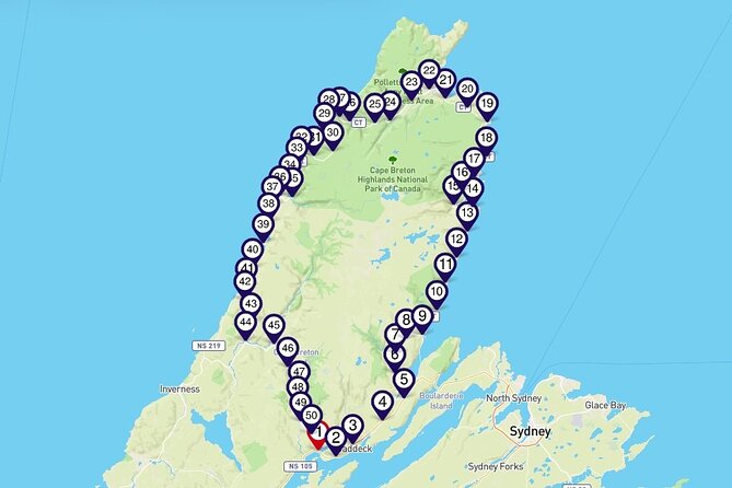
The tour covers roughly four to five hours, but you control the clock. Stop for a hike, lunch, photos, or a beach break, then continue when you are ready. I also like the practical advice about short walks and scenic pull-offs, though much of the content focuses on trails, so it may feel less useful if you plan to stay in the car.
Five useful things to know before driving
- One purchase covers the whole vehicle: Up to 15 people can share one tour, making the $9 fee excellent value for a family or group.
- Download everything on reliable Wi-Fi: Do not wait until you reach the Cabot Trail. Signal can be patchy, and incomplete downloads have caused playback problems.
- Expect GPS-triggered commentary: The app is designed to announce points of interest as you approach, but you may sometimes need to start a stop manually.
- The route is packed with optional stops: You get suggestions for waterfalls, lookoffs, beaches, museums, villages, hikes, and picnic areas.
- It works best for independent drivers: You use your own vehicle, choose your speed, and can stop whenever the view wins the argument.
Why this inexpensive audio guide is worth considering
The Cabot Trail is famous for its scenery, but scenery alone can become a blur after several hours behind the wheel. This tour gives the drive structure. It explains the people, geology, industries, and communities along the way, while also telling you where to pull over.
At $9 per group, the math is hard to argue with. A couple pays less than the cost of many printed guidebooks, while a family or group of friends can split the same small fee across a full vehicle. The tour is private, with no guide waiting at a meeting point and no fixed departure time after you have downloaded it.
That flexibility matters on Cape Breton Island. You may want to spend extra time in Ingonish, stop for a lobster sandwich, walk the Skyline Trail, or wait for a better view at a Gulf of St. Lawrence lookoff. You are not being hurried along by a bus schedule.
The tour is offered in English and is designed for use with a smartphone or tablet. You provide the vehicle and device. Bluetooth connection to a rental car can make the experience much easier, but the essential preparation is the same: install the app, download the full tour, and test the playback before reaching the start point.
The official meeting point is at Buckwheat Corner, Nova Scotia, and the activity is listed as returning there. Still, the audio can be started from another stop, and GPS may adjust to your position. If you drive in the opposite direction, the content remains useful, but references such as on your right may no longer match your view.
More Driving Audio Tours in Canada
- Icefields Parkway: a Smartphone Audio Driving Tour
★ 4.0 · 118 reviews - Smartphone Audio Driving Tour between Banff and Calgary
★ 4.0 · 25 reviews - Self Guided Audio Driving Tour of the North Shore of PEI
★ 4.0 · 24 reviews
Starting near Bras d’Or Lake and Alexander Graham Bell
Early stops introduce Bras d’Or Lake, a long inland sea stretching about 90 kilometers through Cape Breton. Its three long fingers give the center of the island a distinctive shape, and the commentary helps you understand why this body of water matters before the road reaches the highlands.
The Alexander Graham Bell portion adds a human story to the drive. Bell spent time in Baddeck, and the nearby Alexander Graham Bell National Historic Site and Museum offers a chance to continue the subject in person. The audio explains why Bell has a museum here, so the stop is not simply a sign beside the road. If you enjoy museums and local personalities, allow extra time.
The tour also covers the Plaister Mines and what was taken from the ground there. This is the sort of small detail that can make an ordinary stretch of road more interesting. Instead of seeing only trees and rock, you get a sense of the work and industry that shaped Cape Breton.
Scottish influence receives attention too. The story explains how Scots came to Cape Breton and how their culture affected the island. That background becomes especially useful later, when you encounter Scottish names, crofter traditions, and communities tied to Highland settlement.
Waterfalls, wilderness, and easy places to stretch your legs
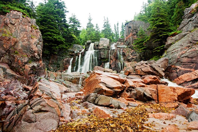
Goose Cove Brook is one of the prettiest sections highlighted early in the drive. Several brooks join before flowing into the cove, and waterfalls along the brook can be reached with relative ease. The audio helps you decide when a roadside stop deserves more than a quick photograph.
The North River Wilderness Area protects more than 5,000 hectares of highland plateau and rugged river valley. The tour points out trails for different ability levels, which is valuable if you want a walk but do not want to commit to a long hike.
Plaster Provincial Park receives its own explanation as you travel along its edge. The subject is partly geology and partly local history, with the audio filling in what you are seeing beyond the roadside trees.
Another stop introduces one of Nova Scotia’s largest and roughest protected areas. The point is not simply to name a park. You get a clearer idea of how much of northern Cape Breton remains wild and why the highlands feel so different from the settled coast.
If you need a break, the tour identifies easy trails and areas with shops. That combination is useful for mixed groups. One person can browse, another can stretch their legs, and nobody has to treat every stop like a serious hike.
Cape Smokey and the first big ocean views

A famous roadside stop has served road trippers since 1976 and is known for lobster sandwiches. The audio flags it as a practical place to stock up, eat, or simply pause. Food stops like this help break up a long drive, especially if you are traveling with children or a group that does not agree on restaurant timing.
As the road climbs Cape Smokey, a pull-off offers a panoramic ocean view. You then continue toward the top of Smokey Mountain and Cape Smokey Picnic Park, where picnic tables, flush toilets, and scenic lookouts make the stop more comfortable than a quick shoulder pull-off.
The tour gives you useful timing advice without forcing a schedule. You might stop before the climb, continue to the picnic park, or skip both if the weather is poor. That freedom is one of the strongest parts of an audio tour. It suggests possibilities without taking control of your day.
More Smartphone Audio Tours in Canada
- Halifax Churches, Gardens & Graveyards: a Smartphone Audio Walking Tour
★ 4.5 · 25 reviews - Halifax Boardwalk & Seaport: a Smartphone Audio Walking Tour
★ 4.0 · 19 reviews - Explore Halifax with 3 Unique Smartphone Audio Walking Tours
★ 4.0 · 16 reviews - Smartphone Audio Driving Tour between Lake Louise and Calgary
★ 4.0 · 15 reviews
Ingonish, beaches, and the highland park
Ingonish is not a single compact village. It includes five communities and sits at the entrance to Cape Breton Highlands National Park. The area offers both fresh and saltwater beaches, which gives you a choice between a lake setting and an open coastal one.
The audio also explains how the two harbors of Ingonish served the Mi’kmaq for more than 9,000 years and continue to support local life and tourism. This is an important reminder that the Cabot Trail is not just a scenic road built for sightseeing. People have used and cared for these waterways for a very long time.
This section is marketed through a broad mix of activities: trails, whales, golf, and even goats. You get a quick guide to what is available, then decide what fits your day. The route also points out camping, beaches, waterfalls, and hikes, which makes this stretch especially useful if you are spending more than one day in the area.
Cape Breton Highlands National Park is described as a place where mountains meet the sea. Glaciers and rivers shaped the highland terrain, creating conditions for plants and animals found nowhere else in Nova Scotia. The tour does not replace a park map or trail guide, but it gives the drive a helpful frame of reference.
Beyond the park, tiny Neil’s Harbour offers a look at a summer fishing community of about 300 residents. It is the sort of stop that adds local character to a route otherwise dominated by grand views.
Geological stories around Aspy Bay

The geological portion is one of the more distinctive parts of the tour. The area is called the Bras d’Or terrane, and the audio explains its connection to ancient continental movement. Later, the Polletts Cove and Aspy Fault Wilderness area is used to describe the collision of three continental plates.
You do not need to be a geology enthusiast to enjoy this. The road becomes easier to read when you know that the cliffs, valleys, and plateaus are the result of immense forces rather than random shapes. The subject also helps explain why the highland scenery changes so quickly.
Aspy Bay offers a beautiful red sand bar protecting North and South Aspy Bays. If you like beaches, this is one of the better reasons to slow down. The tour also points to accessible waterfalls, including one reached by a short walk of a couple of kilometers.
Use current local conditions before setting out on any recommended trail. Access can change with construction, weather, or seasonal closures. One suggested route to Mary Ann Falls has had a permanent pedestrian and cyclist closure since 2022, so this is a place where you should verify conditions instead of relying on old audio instructions alone.
The highland plateaus form the northern end of the Appalachian Mountains, which extend from Florida to Newfoundland. Lookoffs along the road reveal the large fault line cutting through the plateaus. The commentary gives these viewpoints more meaning than a simple instruction to stop for photographs.
Lone Shieling, MacIntosh Brook, and Pleasant Bay

The Lone Shieling is a replica of a Scottish crofter’s hut reached by a magical-sounding 15-minute walk through old sugar maples. Interpretive panels explain its story once you arrive. This is a good stop for anyone interested in Scottish settlement, architecture, or a short woodland walk.
MacIntosh Brook offers another family-friendly option. The trail takes about 30 minutes, follows a lively brook, and ends at a woodland waterfall. Dogs are included in the suggested outing, which is helpful if you are road-tripping with a pet.
Pleasant Bay is presented as Cape Breton’s whale-watching capital. The audio gives you a reason to consider a longer stay, rather than treating the community as another pass-through point.
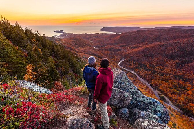
A lookoff provides a broad view of the Gulf of St. Lawrence, while the Fishing Cove Trail entrance offers a view of mountain headlands sweeping toward the ocean. French Lake adds a quieter scene, with a highland lake surrounded by boreal forest.
Moose are another local subject. Cape Breton moose have an unusual history, and the area around the lake is a popular place to look for them as they feed on forest plants and aquatic vegetation. The tour can point out habitat, but wildlife sightings are never guaranteed, so keep your attention on the road and do not stop in unsafe places.
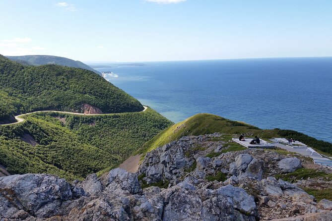
The Skyline Trail is the postcard stop. From the end of the easy, well-groomed path, you see the Cabot Trail curling along French Mountain below. It is one of the most important walks on the route, but the audio cannot tell you how long you will want to linger once you reach the view. Give yourself more time than the basic drive estimate if this is a priority.
Acadian stories along the western side
The western side of the route shifts the focus from highland scenery to Acadian settlement. One trail passes through an area where 30 Acadian families once lived, including people displaced by the 1755 expulsion in Nova Scotia.
Le Buttereau means little hill in French. At one time, seven Acadian families lived there, and the commentary explains more about their settlement. The Cheticamp River marks the western entrance to the national park and provides access to a campground and four nearby trails, including Le Chemin du Buttereau.
Near the river, a long sweep of gravel and sand crosses the tidal estuary. It almost closes the river off from the sea and creates a striking coastal shape. These are the kinds of details the audio handles well: not only where to look, but why the place appears as it does.
Cheticamp is one of the world’s Acadian centers. You can find whale watching, a museum, restaurants, and a golf course. Plage St. Pierre on Cheticamp Island offers a sandy beach and campground if you want a slower afternoon.
The tour also introduces Mi-Carême, an Acadian tradition involving masks and celebration. If time allows, the Centre de la Mi-Carême lets you learn more and make your own mask. This is a welcome change from scenic overlooks and gives the drive a stronger connection to living culture.
Margaree River, fishing, and the final stretch
As you continue south, the terrain flattens and the Gulf opens into view. The sea here forms a productive marine area known as the Cape Breton Trough. Belle Cote translates as beautiful coast, and a detour along Belle Cote Beach Road helps explain the name.
The Margaree Harbour can look like a lake when you cross the bridge. At nearly one kilometer wide, the Margaree River estuary is far larger than many people expect. East Margaree Crossing offers views of the river winding along the valley floor, with the possibility of seeing someone fishing in the shallows.
The surrounding hills belong to the Appalachian range. A stop connected with Live Life in Tents River Tours introduces options ranging from primitive camping to glamping, along with river trips through rapids. The tour provides the lead, but you will need to arrange any separate activity yourself.
The Margaree Salmon Museum and nearby Margaree Fish Hatchery give anglers a reason to pause. Even if you do not fish, the stops add another layer to the river story.
A roadside picnic park offers a view across a lake toward low mountains. Another stop points out an old mine in the hills and asks you to guess what was extracted there. The final unusual sight is a pair of matching white clapboard churches with gray spires. The audio explains why these twin-looking churches sit side by side.
App performance and how to avoid frustration
The concept is simple, but the app deserves careful preparation. Some users have found the download process confusing, and some have needed to call customer support before getting started. Others have had smooth playback, automatic narration, and reliable GPS triggering.
Your best approach is practical:
- Download the complete tour on strong Wi-Fi.
- Run the tutorial before reaching Cape Breton.
- Play the first stop so you understand the sounds and controls.
- Connect to Bluetooth before driving.
- Keep the phone mounted and let the driver focus on the road.
- Be ready to start a stop manually if the audio does not advance.
The app may not always auto-play, especially if the download is incomplete or you begin away from the official start. It can also play items out of sequence. Starting at stop one gives you the clearest introduction, but you can adapt if your road trip begins elsewhere.
The tour is yours to keep, with flexible dates and no time limit. That means you can spread the route across more than one outing if you wish, though the advertised driving time is about four to five hours.
Who should book this Cabot Trail tour?
Book it if you are driving your own car, want context while you travel, and appreciate suggestions for short walks and scenic pull-offs. It is especially good for families, couples, and groups sharing one vehicle because the price covers up to 15 people.
It is also a strong choice if you dislike fixed tours. You can stop for lobster, skip a trail, spend an hour at the Alexander Graham Bell museum, or linger at the Skyline viewpoint without asking permission.
Skip it if you want a polished, hands-free system that never needs attention. The occasional manual playback issue may bother you. You should also look elsewhere if you want a dedicated human guide, detailed hiking directions, or a tour focused only on scenery rather than history and local stories.
For most independent road trippers, I would book it. At $9 per vehicle, the possible payoff is high: better timing, more context, and several stops you might otherwise miss. Just download it early, test it before departure, and treat the audio as a helpful companion rather than a substitute for current trail and road information.
FAQ
How much does the Cabot Trail audio tour cost?
The tour costs $9 per group, and one purchase covers a vehicle with up to 15 people.
How long does the audio tour take?
The approximate driving time is four to five hours, but there is no time limit. You can stop and continue at your own pace.
Do I need cell service during the tour?
You need a good mobile or Wi-Fi connection for the initial download. After the tour is fully downloaded, no signal or mobile data is required during the drive.
Where does the tour start?
The listed starting point is Buckwheat Corner, Nova Scotia, postal code B0E 1B0. The activity is listed as ending back at the meeting point.
Can I use the tour in the opposite direction?
Yes, the tour can be started at another stop, and GPS may adjust to your position. However, directional phrases such as right and left may not match if you drive in the opposite direction.
Can I cancel for a full refund?
Yes. You can cancel at least 24 hours before the experience start time for a full refund. Cancellations or changes made within 24 hours are not refunded or accepted.
Just added around Canada
- Queen Street West: An audio tour exploring Toronto’s coolest street★ 3.5 · 2 reviews
- Toronto’s Waterfront: a Smartphone Audio Walking Tour★ 5.0 · 5 reviews
- St. John’s Audio Walking Tour★ 4.0 · 4 reviews
- Irish Loop Smartphone Audio Driving Tour★ 4.5 · 7 reviews
- Fruit alcohol tasting + Velvet Orchards audio tour★ 5.0 · 2 reviews
- APP Self-Guided Tours Quebec with Audioguide★ 3.0 · 2 reviews
- Quebec City Self-Guided Driving Audio Tour★ 4.0 · 7 reviews
- Smartphone Audio Driving Tour between Wasaga Beach and Toronto★ 4.5 · 3 reviews
Driving Audio Tours, compared.


Ultimate Acadia National Park Self-Guided Driving Audio Tour
Read our review →



Browse the lists this tour appears in