
REVIEW · MOAB AUDIO TOURS
Canyonlands National Park Self-Guided Driving Audio Tour
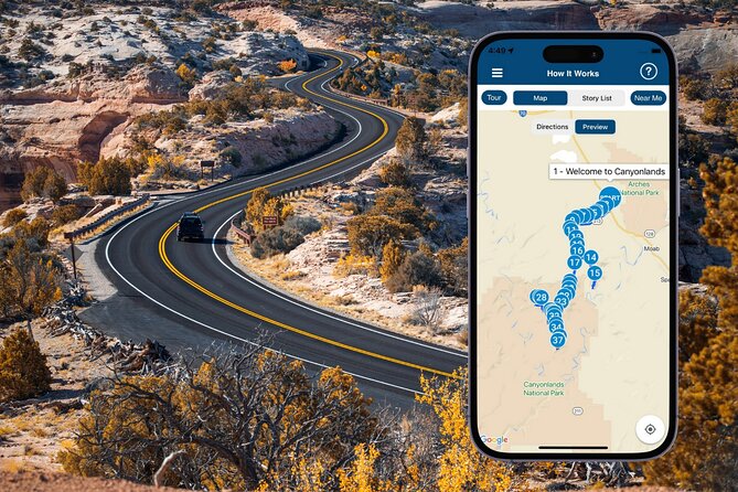
Canyonlands rewards a little guidance. This self-guided drive turns your own car into a private tour vehicle, with GPS-triggered stories, offline maps, and more than 37 audio stops across a route of over 62 miles. I especially like the freedom to stop and pause, plus the useful explanations of geology, local stories, trails, and overlooks. The main catch is setup: you must download the tour and receive your access code before entering areas with weak service.
At $16.99 per car for up to four people, the price is hard to quarrel with. I also like that your access never expires, so you can use the tour again on another visit. Just keep in mind that the advertised one to two hours refers mainly to driving and listening, not a full sightseeing day with hikes, photos, meals, and traffic.
Key points before you set out
- The route begins near Moab Giants Cafe: Start at 112 UT-313, then follow the audio prompts toward Canyonlands and finish at Grand View Point.
- The tour covers more than 62 miles: You get over 37 stories, with content about geology, Native granaries, cowboys, rivers, arches, and major viewpoints.
- The app works offline after downloading: Install everything while you have strong Wi-Fi or cellular service.
- The price covers the whole car: One purchase works for a group of up to four people, not just one passenger.
- The route needs to be followed in the right direction: Starting elsewhere or driving too fast can cause missed stories or poor timing.
- The park entrance pass is separate: This audio tour does not include your Canyonlands admission permit.
What this Canyonlands audio tour actually does

This is not a guided bus ride or a live tour with someone waiting at the entrance. You drive your own car, open Action’s Tour Guide app, and let GPS trigger the narration as you reach each point.
That arrangement suits Canyonlands unusually well. The park is spread out, roads are long, and many of the best views come from short pullouts rather than one compact sightseeing area. A live guide would give you information, but it would also set the pace. Here, you can stop for ten minutes, skip a story, return later, or spend half a day taking photos.
The narration mixes practical directions with explanations of what you are seeing. It points out where to turn, where to pull over, and why a particular rock formation or river view matters. Several people especially liked the historical and scientific material, along with the narrator’s calm voice, music, and side comments.
The app also keeps track of your location. That is useful on a long park road where one viewpoint can begin to look much like the next. You are not constantly checking a printed map to figure out which overlook comes next.
More Self-Guided Audio Tours in the USA
- Arches National Park Self-Guided Driving Audio Tour
★ 4.5 · 288 reviews - Arches and Canyonlands NP Self-Guided Driving Audio Bundle Tour
★ 4.5 · 68 reviews - Utah Mighty 5 National Parks Self-Guided Driving Audio Tours
★ 4.5 · 25 reviews
Starting near Moab and crossing The Neck
The official starting point is Moab Giants Cafe on UT-313. No one meets you there. You simply arrive, open the app, and enter the first story point. The audio should begin when you reach the proper location.
The early route introduces The Neck, a narrow strip connecting the Island in the Sky mesa to nearby mesas. The explanation gives you a helpful mental picture: Island in the Sky is a broad, high mesa surrounded by lower country, and The Neck acts like a natural land bridge.
This early section matters because Canyonlands can feel enormous and abstract at first. The audio gives names and structure to the rock country before you reach the big overlooks. It also helps you understand that the park is not one single canyon viewpoint. It is a large system shaped by the Colorado River, the Green River, and tributary canyons.
As you approach the park, the narration may also point out nearby features such as Corona Arch, a sandstone arch near Moab that shares a formation with Pinto Arch and Bowtie Arch. This is useful context, though not every feature mentioned is a stop where you will get out of the car.
White Rim, biological soil crust, and the rules beneath your feet
One of the most worthwhile early explanations concerns biological soil crust. This dark, fragile surface covers parts of the desert around Canyonlands, Arches, and Moab. It may look like ordinary dirt, but it is a living crust that helps protect the soil from erosion.
The practical message is simple: stay on established paths and do not wander across the open ground for a better photo. The subject may sound small compared with a canyon, yet it is exactly the kind of detail you can miss when driving without interpretation.
The route also introduces the White Rim area. You may not be driving every rough road associated with the White Rim, but the story places the Island in the Sky views within the wider setting of cliffs, mesas, and river-cut country.
The audio is at its best when it connects a rule to a reason. Instead of merely telling you where not to walk, it explains what is underfoot and why your choices matter.
River country: Cataract Canyon and Green River Overlook
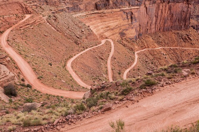
Cataract Canyon is a 46-mile canyon cut by the Colorado River within Canyonlands National Park and Glen Canyon National Recreation Area. The tour uses it to explain the scale of the river system and the way water continues to shape the park.
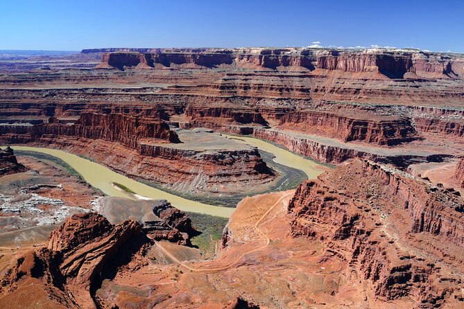
At Green River Overlook, you get one of the most memorable views in the Island in the Sky District. The Green River continues its work far below, winding through broad canyon country. The narration adds a bit of local explanation about the river’s name and its importance in Utah.
This is a good example of why an audio guide helps. A viewpoint can be visually obvious but geographically confusing. The cliffs, mesas, and river channels spread in every direction. A few well-timed facts help you read the scene instead of simply admiring red rock.
The park has very little infrastructure once you are out on the road, so the Visitor Center stop deserves attention. You can use the bathroom, get supplies, and refill water bottles. Do not treat this as a casual detail. The heat, distance, and lack of services can turn a simple drive into an uncomfortable one if you start without enough water.
More Driving Audio Tours in Moab:
- Full-Day Audio Driving Tour of Arches National Park
★ 4.5 · 27 reviews - Self Guided Audio Driving Tour in Arches National Park
★ 3.5 · 6 reviews - Goblin Valley Self Guided Driving Audio Tour
★ 4.0 · 4 reviews - Self Guided Audio Driving Tour of Canyonlands
★ 5.0 · 2 reviews
Pullouts that make the drive worthwhile
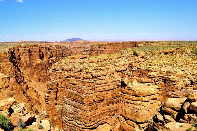
The route calls out several places where stopping is especially useful. Plateau Viewpoint offers broad views, an information panel about anthropological work, and a handicap-accessible toilet. Big Mesa Viewpoint gives you another chance to see the enormous mesas that seem almost misplaced in the desert.
The tour also points out a three-sided overlook with a direct view into the canyon. If heights bother you, this stop may feel exposed because there is little between you and the drop. The audio does not hide that fact, which is helpful. You can decide in advance whether to step out or enjoy the view from a safer-feeling position.
At another overlook, you can see Buck Canyon and the La Sal Mountains. The short path is paved, and a rail provides a clear barrier near the edge. This makes it one of the easier viewpoints for anyone who prefers a firm walking surface and a little extra protection from the drop.
A small picnic area offers eight tables and a chance to eat. Bring your own food. The route does mention a cafe at one stop, but food options inside the park are limited, so you should not plan the day around finding a meal along the road.
Mesa Arch and the formations you will remember
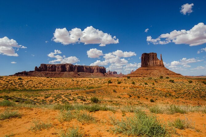
Mesa Arch is the classic stop, and the tour treats it accordingly. After parking, you walk a short trail to the arch, passing juniper and pinyon trees along the way.
The audio encourages you to notice those trees rather than rushing straight to the opening in the rock. That is a small but useful habit. Canyonlands is not only cliffs and bare stone. The plants tell you something about the high desert setting as well.
The route also identifies Candlestick Tower, a formation that looks like three giant candles rising from the rock. Its layers shift from white to reddish-brown to red, giving the formation a stacked, cake-like appearance.
Another stop describes a rock formation shaped like a whale. An easy one-mile hike follows the whale’s back and rewards you with views toward Upheaval Dome. The comparison is playful, but the directions are practical. You know what to look for and what the walk adds before deciding to leave the car.
Upheaval Dome itself is one of the park’s more curious features. The audio uses it as a visual destination, connecting the odd shape of the rock to the broader story of layers and forces that shaped Canyonlands.
Murphy Point, granaries, and stories from the old West
The walk to Murphy Point Overlook is about 3.5 miles round trip and is described as fairly easy. The trail itself may not deliver constant scenery, but the view from the end looks into Stillwater Canyon and toward the Green River.
That distinction is worth knowing. Not every worthwhile hike is spectacular from the first step. If your time is limited, you can decide if the final view justifies the out-and-back distance. The audio helps you make that choice instead of promising nonstop drama.
Another stop highlights ancient granaries built by Native peoples. They are hundreds of years old and can be seen from the base of the final hill. You should approach carefully and keep your distance. These structures are fragile, and the point is to see them without treating them like a prop for a photo.
The tour also adds the human stories behind place names. Many Canyonlands features carry names linked to cowboys and ranchers, including the Chaffin family. The Orange Cliffs received working names from cowboys too, including Under the Ledge, a descriptive term for a section beneath a large rocky shelf.
These details give the park a human timeline without pretending the modern road is the whole story. Native use, ranching, river travel, geology, and tourism all occupy different chapters here.
Dead Horse Point and the Merrimac and Monitor
Dead Horse Point gets one of the tour’s more colorful explanations. Local legend says wild mustangs were corralled and sorted here in the early 1800s. Once the desirable horses were claimed, the less desirable ones were left behind.
The story is memorable, though you should take it as local legend rather than a proven account. That is part of the appeal of place names in the Moab area: they often preserve rough, practical stories from ranching and river country.
Elsewhere, the route passes through the floor of Sevenmile Canyon. Tall rock walls can block your view at first, then open toward the Merrimac and Monitor formations. The audio prepares you for that change, so you know to watch the right side of the road instead of missing the sight while looking elsewhere.
This is where the GPS format earns its keep. The narration arrives as you approach the feature, not as a long lecture delivered before you know what to look for.
Grand View Point and the end of the route
Grand View Point is the stated finish, and it makes a fitting endpoint. The tour closes by returning to the park’s layered rock, noting that many layers have remained largely undisturbed since they formed hundreds of millions of years ago.
The final point is not only about age. It changes the way you see the entire drive. Those bands of color are not random decoration. They record deposits laid down over immense periods, later cut by rivers and weather.
The route ends with suggestions for other nearby audio tours, including Arches, Bryce, and Zion. You do not need to buy anything else to use this tour, and the sales message at the end is easy enough to skip.
How long should you allow?
The basic tour is described as taking one to two hours. That is realistic only if you drive the route with limited stops and do not spend much time hiking, eating, or taking photographs.
For a proper visit, allow more time. One person used about five hours to cover the recommended route with family, stops, and a relaxed pace. That is a better planning figure if you want to get out at viewpoints and walk to places such as Mesa Arch or Murphy Point.
The app plays stories automatically, but speed matters. One particularly useful warning is that the posted speed limit can sometimes be faster than the narration. If you drive too quickly, the next story may trigger late or a section may be missed. Stay within the limit, but slow down enough to match the app when traffic and road conditions allow.
App setup, offline use, and common snags
Download the separate Action’s Tour Guide app before you reach the park. After booking, you receive setup instructions and a password by email and text. Search for audio tour if the message is hard to find.
The most important step is downloading the actual tour while you have strong Wi-Fi or cellular service. Once downloaded correctly, it is designed to work without a signal. Canyonlands has weak or absent service in many areas, so waiting until you reach the park is a poor gamble.
A few practical problems can occur. Access codes may arrive late, and starting from a different place can cause the narration to fall out of sequence. If you start at the official point, follow the route in the intended direction, and confirm the download before leaving town, the system should be much less troublesome.
Connect your phone to the car by Bluetooth, USB, or AUX. Apple CarPlay works for audio playback, while Android Auto support is still listed as forthcoming. An iPhone using iOS 15 or later, an Android device using version 9 or later, or a GPS-equipped tablet with cellular service is recommended.
Is $16.99 good value?
Yes, especially for a group of two to four people. At $16.99 per car, the cost is lower than paying several individual admission fees for a live activity, and you keep control of the day. The tour is also private, so your group does not have to fit a stranger’s schedule or conversation.
The value comes from the interpretation rather than transportation. You still need your own vehicle, park pass, food, water, and fuel. But the app gives you route guidance, historical context, geology, safety reminders, and names for the formations in front of you.
Lifetime access improves the deal. You can pause the tour, use it over several days, or listen again on a future visit. That matters if your first day gets cut short or you want to divide the route into smaller sections.
Who should book this tour?
I would choose it for a first visit, a family group, couples who want privacy, and anyone who enjoys learning while driving. It is especially useful if you have limited time and want a clear list of major overlooks without researching every stop in advance.
It is less suitable if you want a silent scenic drive, dislike using a phone for navigation, or expect a live guide to answer questions. The route also requires more preparation than the price suggests. Downloading the app, finding the code, charging your phone, and packing water are part of the experience.
The narration has received strong praise for its voice, music, historical details, and scientific explanations. Still, technology can be fussy. Use the official start point, drive the route in order, and do not assume cell service will rescue you.
Should you book it?
Book it if you want an affordable private guide for your own car and prefer to set the pace yourself. The strongest reasons are the clear route, automatic GPS stories, useful stop advice, and low per-car price.
Skip it if you already know Canyonlands well or want to create your own completely quiet itinerary. For most first-time visitors, though, $16.99 is a sensible way to add meaning to a long, sometimes confusing drive. Just download it before you leave Moab, bring water and snacks, and give yourself more than two hours if you plan to explore on foot.
FAQ
Where does the Canyonlands audio tour start?
The tour starts at Moab Giants Cafe, 112 UT-313, Moab, Utah.
Where does the tour end?
The stated ending point is Grand View Point in Canyonlands National Park.
How long is the route?
The route is more than 62 miles long and includes over 37 audio stories. The basic drive is described as taking about one to two hours, but a full visit with stops and walks can take longer.
Does the tour include the Canyonlands entrance pass?
No. A park entrance permit is required, and it is not included in the tour price.
How much does the tour cost?
The price is $16.99 per group of up to four people in one vehicle.
Does the audio tour work without cell service?
Yes, after you download the tour properly, it is designed to work offline. You must download it while you have strong Wi-Fi or cellular service.
How do I start the audio tour?
Download Action’s Tour Guide app, enter the password sent by email and text, go to the starting point, and open the tour. The first story should begin automatically when you reach its location.
Can I pause the tour or use it on another day?
Yes. The tour has lifetime access with no expiry. You can pause it, resume it later, use it over several days, and take breaks for food, photos, or side trips.
What devices are recommended?
An iPhone with iOS 15 or later, an Android device with version 9 or later, or an iPad or tablet with GPS and cellular connectivity is recommended. You can connect the audio to your car using Bluetooth, USB, or AUX.
More Self-Guided Audio Tours in Moab
- Self Guided Audio Tour in Arches and Canyonlands
★ 4.5 · 16 reviews - Utah Mighty 5 Adventure Bundle: 8 Self-Guided Audio Tours
★ 5.0 · 4 reviews - La Sal Mountain Loop Self-Guided Audio Tour
★ 3.5 · 4 reviews - Self Guided Audio Tour Bundle for Utah’s Mighty Five
★ 5.0 · 3 reviews
More National Park Audio Tours in Moab
- Canyonlands National Park Self-Guided Audio Tour
★ 4.0 · 5 reviews - Joshua Tree National Park Self-Guided Driving Audio Tour
★ 4.5 · 762 reviews - Ultimate Acadia National Park Self-Guided Driving Audio Tour
★ 4.0 · 521 reviews - Yellowstone National Park Self-Guided Driving Audio Tour
★ 4.5 · 249 reviews
Just added around Moab
- Utah Mighty 5 Adventure Bundle: 8 Self-Guided Audio Tours★ 5.0 · 4 reviews
- Utah Mighty 5 National Parks Self-Guided Driving Audio Tours★ 4.5 · 25 reviews
- Self Guided Audio Tour Bundle for Utah’s Mighty Five★ 5.0 · 3 reviews
- Self Guided Audio Driving Tour in Arches National Park★ 3.5 · 6 reviews
- Goblin Valley Self Guided Driving Audio Tour★ 4.0 · 4 reviews
- Delicate Arch Trail Self-Guided Audio Walking Tour★ 4.0 · 2 reviews
- Self Guided Audio Driving Tour of Canyonlands★ 5.0 · 2 reviews
- Self Guided Audio Tour in Arches and Canyonlands★ 4.5 · 16 reviews
Driving Audio Tours, compared.


Ultimate Acadia National Park Self-Guided Driving Audio Tour
Read our review →



Browse the lists this tour appears in