
REVIEW · MOAB AUDIO TOURS
La Sal Mountain Loop Self-Guided Audio Tour
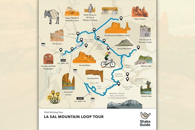
Moab’s red rock country has a cool, high-altitude side. This self-guided drive pairs the La Sal Mountain Loop with alpine lakes, Castle Valley views, dinosaur tracks, river stops, and sandstone towers. I like the private, flexible format because you can start when you want, skip stops, and pause the narration for a hike or lunch. I also like the one-price-per-car value, since the $15.99 cost covers a group of up to 15 people rather than charging each person.
The main caution is road and app reliability. The mountain loop can close, and one poor experience involved wrong directions and audio that cut in and out. Download everything on strong Wi-Fi, check road conditions before setting out, and keep a map handy as a backup.
Key points to know
- A $15.99 tour covers up to 15 people: That makes it especially good for families or larger groups sharing one vehicle.
- The route includes more than mountain scenery: You’ll reach lakes, waterfalls, dinosaur tracks, river access points, pictographs, film locations, and famous climbing formations.
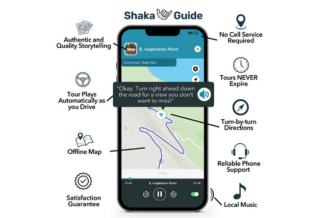
- Offline GPS is the main convenience: After downloading the tour, the map, directions, stories, and music work without mobile data or Wi-Fi.
- The advertised drive takes about four to six hours: Add extra time for hikes, fishing, photography, and the optional Brumley Arch and Bull Canyon detours.
- Road conditions matter: The La Sal Mountain Loop has closed during past visits, so confirm access before counting on the full route.
- You control the day: The tour never expires, and you can pause or resume it, even across multiple days.
What You Are Buying for $15.99
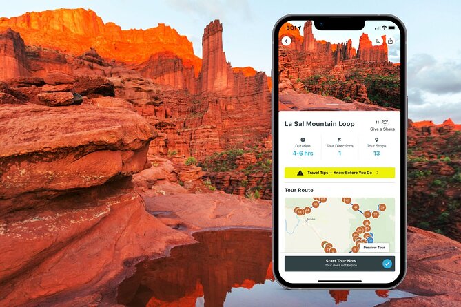
This is not a guided van trip with a driver. You bring your own vehicle and follow a GPS-triggered audio route through the Moab area. The app gives turn-by-turn directions, plays narration automatically as you drive, and adds stories, music, travel tips, activity ideas, and restaurant suggestions.
The price is unusually simple. One purchase covers up to 15 people in the vehicle, with no per-person fee. A couple pays the same $15.99 as a full carload, which makes this a better deal for families and groups than many conventional tours.
I would not judge the value by the four to six hour estimate alone. The real benefit is the flexibility. You can stop for 10 minutes at a viewpoint, spend longer at a lake, skip a strenuous hike, or pause the tour for a meal. The audio access does not expire, so you are not forced to cram every stop into one afternoon.
Entrance fees, meals, and drinks are not included. The listed stops are described as free, including the museum stop at Moab Giants, but you should still plan for your own food, fuel, and any separate activity costs.
More Self-Guided Audio Tours in the USA
- Arches National Park Self-Guided Driving Audio Tour
★ 4.5 · 288 reviews - Arches and Canyonlands NP Self-Guided Driving Audio Bundle Tour
★ 4.5 · 68 reviews - Canyonlands National Park Self-Guided Driving Audio Tour
★ 4.5 · 54 reviews
Start at North Highway 191
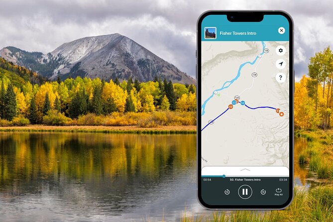
The tour begins at North Highway 191 in Moab, Utah, and returns to the same meeting point. The stated operating dates run from April 1, 2022, through December 20, 2026, with the tour available at any time of day.
That broad schedule is useful in Moab, where sunrise, heat, traffic, and summer storms can shape your plans. Start early for a quieter drive and cooler conditions, or begin later if you want to spend the morning elsewhere. The app lets you pause and resume, so the route does not have to be treated as one rigid outing.
Before leaving town, redeem the code sent by email in the Shaka Guide app. Then download the tour over strong Wi-Fi. This step matters. The route is built to work offline, but only after the map and audio have been downloaded.
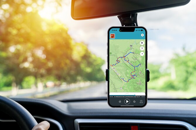
The audio is designed to play hands-free while you drive. Still, the driver should not be managing the phone on the road. Set up the tour before pulling away, and let another person handle pauses or route checks when possible.
Ken’s Lake and the First Mountain Views
Ken’s Lake is an easy opening stop. The lake sits below the La Sal Mountains, giving you a quick change from Moab’s red-rock setting to water and high peaks. A short walk can take you to a small waterfall, and the area is also a popular campground.
The suggested stop time is about 20 minutes. That is enough for a look around and a short walk, but not enough for a leisurely picnic or extended hike. If you are driving with children, this may be one of the simplest places to stretch your legs early in the route.
Ken’s Lake is also a useful reminder that this is a driving tour, not a march from one attraction to the next. You can stay longer if the setting appeals to you. The audio continues to be available when you are ready to leave.
Brumley Arch Requires More Effort
Brumley Arch adds a real physical challenge. The trail is about two miles round trip, but it is steep and strenuous. Reaching the trailhead also requires an optional gravel-road drive, so you should be comfortable with that road before choosing this stop.
The reward is a waterfall and the Brumley Arch formation. The listed 20-minute stop time does not fit the full hike, so treat that number as a suggested narration point rather than a complete visit. You will need extra time for the walk, pauses, and the drive along the gravel road.
I like that the route gives you the choice instead of making every person in the car commit. If you want a relaxed sightseeing day, skip Brumley Arch. If you have sturdy footwear, enough water, and time for a strenuous outing, it offers one of the more active stops on the route.
More Self-Guided Audio Tours in Moab:
- Utah Mighty 5 National Parks Self-Guided Driving Audio Tours
★ 4.5 · 25 reviews - Self Guided Audio Tour in Arches and Canyonlands
★ 4.5 · 16 reviews - Self Guided Audio Driving Tour in Arches National Park
★ 3.5 · 6 reviews - Canyonlands National Park Self-Guided Audio Tour
★ 4.0 · 5 reviews
Oowah Lake and Warner Lake at 8,800 Feet
Oowah Lake sits at about 8,800 feet, or more than 2,600 meters. That elevation gives the stop a completely different feel from Moab’s canyon floor. The small alpine lake is popular for rainbow trout fishing, and the La Sal Mountains may reflect in the water on calm days.
Warner Lake is slightly smaller and offers another quiet fishing setting. A 1.6-mile round-trip trail connects Warner and Oowah lakes, giving you a manageable way to turn the two brief stops into a longer walk. Other trails in the area include Boudreaux Pass and Schuman Gulch.
Summer weekends and holidays can bring a small crowd, so do not expect perfect solitude at these popular lake areas. Even so, they provide a welcome break from the car. If you plan to fish, hike, or simply sit beside the water, allow much more than the suggested 20 minutes.
Because the route reaches high elevation, conditions may differ sharply from Moab. The supplied information does not promise a particular temperature or road condition, so check current access before setting out. The road closure issue is not a minor detail here. If the loop is closed, you may be unable to complete the mountain portion.
Castle Valley Gives You the Big View
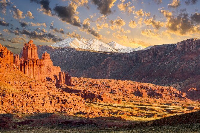
Castle Valley is one of the strongest scenic stops. From the drive, you can look across the Colorado Plateau toward Porcupine Rim, Castle Valley, Arches National Park, and Canyonlands National Park.
This is the place to slow down. The view is broad rather than intimate, so it helps to take time to identify the formations and understand how the high La Sal country relates to the lower red-rock world around Moab.
The audio commentary earns its keep here by adding context while you look. You are not simply pulling over for another attractive photo. You are seeing several major Moab-area features in one sweep.
Bull Canyon Tracks and Castleton Tower
Bull Canyon Overlook and Dinosaur Track Site requires a detour of about 30 to 40 minutes, but no hike is needed. Dinosaur tracks remain in the ground from roughly 200 million years ago, during the Jurassic period.
This is a good stop for anyone who likes physical evidence more than another viewpoint. The tracks are easy to pair with a driving itinerary because the site does not demand a long walk. You will still want to allow time to find and examine the track area rather than treating the detour as a quick roadside photograph.
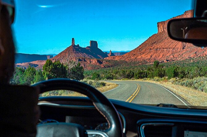
Castleton Tower introduces a different kind of Moab spectacle. The area includes sandstone towers such as Castleton Tower, the Rectory, and Sister Superior, with formations rising as high as 1,400 feet.
You do not need to climb to appreciate them. The formations are a reminder that the Moab area is important to climbers, but the tour lets you enjoy the scale from the road. If you are building a four-hour day, this is an efficient scenic stop. If you are photographing the towers, allow extra time.
Parriott Mesa and the Limits of a Quick Stop
Parriott Mesa rises above Castle Valley like a broad sandstone lookout. Its summit reaches more than 6,000 feet, and the formation stretches over 1.5 miles in length while measuring about a third of a mile across.
A three-mile round-trip hike leads toward the summit, but it is challenging and requires careful preparation. This is not a casual add-on between two audio prompts. You should only consider it if you are properly equipped and ready for a demanding outing.
For most people, the main value is the view from below and the chance to understand the scale of the mesa. The tour does not force you into a hike that may not suit your day. That choice is one of the format’s best features.
Fisher Towers, Hollywood, and Red Cliffs Lodge
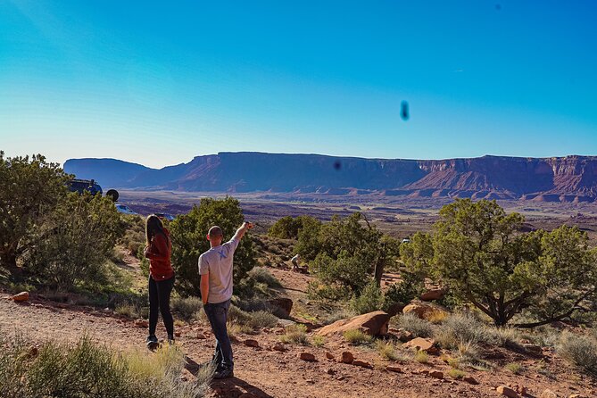
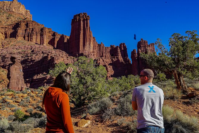
Fisher Towers offers a popular trail through sandstone towers, spires, hoodoos, ravines, and terraces. The formations have also appeared as backdrops in films such as Austin Powers 3 and 6 Underground.
You can treat this as a short scenic stop or pair it with the hiking trail for a longer visit. The suggested 20 minutes is enough to see the formations from a stopping point, but not enough for a relaxed hike through the area.
Nearby, the Moab Giants stop adds a bit of local film and pioneer history. The museum is part of Red Cliffs Lodge, where films including Wagon Master, Rio Grande, Taza Son of Cochise, and City Slickers were shot. It also displays pioneer artifacts and photographs of Hollywood figures connected with the productions.
Admission to the museum is described as free. That makes it an easy stop when you want something besides geology. The mix of old film memorabilia and regional artifacts gives the drive a human side.
Salt Wash and Takeout Beach Along the Colorado
Salt Wash is where the Salt Wash River meets the Colorado River. The water connection is especially interesting for paddlers. With a kayak, you can follow Salt Wash upstream and eventually emerge near Delicate Arch inside Arches National Park, according to the tour information.
That is a detail worth hearing even if you are not carrying a boat. It shows how connected the local waterways are beneath the separate names on a map. You should not treat it as an included kayaking activity, since the tour provides neither equipment nor a guide.
Takeout Beach is where many kayaking and rafting trips finish along the 13-mile daily section of the Colorado River near Moab. This stop helps explain the river’s role in the local recreation economy. It may appeal most to people who have been on the water or are considering a future trip.
Meals and refreshments are not included, so this section is not a replacement for carrying food and water. The route gives you places to see, not a catered day out.
Courthouse Wash and Fremont Rock Art
The final stop is Courthouse Wash, where a pictograph created by the Fremont people about 2,000 years ago can be reached by a short walk of roughly 500 feet from the parking area.
This is one of the most meaningful stops because it connects the area to people who lived here long before modern tourism, road trips, or Hollywood productions. The walk is brief, but treat the rock art with care. Look closely, stay on the established path, and do not touch the panel.
The stop also gives the tour a strong finish. After lakes, cliffs, film sites, and river access, you end with a direct link to the human past of the region.
How Reliable Is the App?
The app’s design is its main strength. GPS-triggered narration, offline maps, automatic stories, turn-by-turn directions, and music can make a solo drive feel more informed without placing you in a group.
The system is also private. Only your own group participates, and you can set the pace. That is useful when one person wants to photograph every viewpoint and another wants to keep moving.
But you should not assume technology will work perfectly every time. One purchase experience involved directions sending the driver the wrong way and audio cutting in and out. The result was a self-guided drive without dependable guidance.
To reduce that risk:
- Download all audio and map data on strong Wi-Fi before departure.
- Start with the phone fully charged.
- Keep the written starting point, North Highway 191, available.
- Check the La Sal Mountain Loop road status before leaving.
- Be ready to follow your own route if the audio fails.
- Contact Shaka Guide by phone, chat, or email if technical problems occur.
The mixed 3.5 rating from four submitted scores reflects this tradeoff. The concept is strong, but road closures and app problems can affect the day.
Who Will Get the Most from This Tour?
I would recommend this tour to families, couples, and groups who already have a vehicle and want information without a fixed departure time. It is especially good for people who like choosing their own stops, since you can skip the steep hikes and linger at the lakes or overlooks.
It also suits repeat visitors who want to explore beyond the busiest Moab sights. The route adds high mountain lakes, Castle Valley, river access, dinosaur tracks, pictographs, and film history to the usual red-rock itinerary.
I would be more cautious if you need a guaranteed route, a human guide, or perfectly dependable navigation. A conventional guided outing may be a better choice if you do not want to monitor road conditions or handle a backup plan.
Most people can participate, and service animals are allowed. The hike options vary widely, so the driving portion can suit a broad range of abilities even when individual trails do not.
Booking, Timing, and Cancellation
Plan on four to six hours for the driving route, then add time for any hike or detour. Brumley Arch, the Oowah and Warner Lake connection, Parriott Mesa, and Fisher Towers can all turn a short stop into a much longer visit.
Free cancellation is available if you cancel at least 24 hours before the scheduled start time. Cancellations within 24 hours are not refunded, and changes inside that window are not accepted.
Should You Book the La Sal Mountain Loop Tour?
Book it if you value freedom, have your own car, and want a low-cost audio companion for a full day around Moab. At $15.99 for an entire group, the price is hard to argue with, especially when the tour never expires and can be used across more than one day.
Before paying, check the mountain road status and make sure you can download the app properly. If the road is open and the app behaves, you get a generous mix of scenery and local stories for very little money. If access is uncertain or you require flawless directions, wait, confirm conditions, and keep a backup route ready.
FAQ
How much does the La Sal Mountain Loop Self-Guided Audio Tour cost?
The tour costs $15.99 per group, with up to 15 people included.
How long does the tour take?
The suggested driving time is approximately four to six hours. Hikes, fishing, photography, and detours can make the outing longer.
Where does the tour start?
It starts at North Highway 191, Moab, Utah 84532, USA.
Where does the tour end?
The activity ends back at the starting meeting point.
Is the tour available offline?
Yes. After you download the map and audio over strong Wi-Fi, the GPS and map work without Wi-Fi or mobile data.
Does the tour expire?
No. The tour includes lifetime access and does not expire.
Is the tour offered in English?
Yes. English is the stated language.
Are entrance fees included?
Meals, refreshments, and entrance fees are not included. The listed stops are described as free, including the Moab Giants museum.
Can I skip stops or pause the tour?
Yes. You can choose the stops you want, skip others, and pause or resume the tour according to your schedule.
What happens if I need to cancel?
You can receive a full refund by canceling at least 24 hours before the scheduled start time. Cancellations made within 24 hours are not refunded.
Just added around Moab
- Utah Mighty 5 National Parks Self-Guided Driving Audio Tours★ 4.5 · 25 reviews
- Utah Mighty 5 Adventure Bundle: 8 Self-Guided Audio Tours★ 5.0 · 4 reviews
- Self Guided Audio Tour Bundle for Utah’s Mighty Five★ 5.0 · 3 reviews
- Self Guided Audio Driving Tour in Arches National Park★ 3.5 · 6 reviews
- Goblin Valley Self Guided Driving Audio Tour★ 4.0 · 4 reviews
- Delicate Arch Trail Self-Guided Audio Walking Tour★ 4.0 · 2 reviews
- Self Guided Audio Driving Tour of Canyonlands★ 5.0 · 2 reviews
- Self Guided Audio Tour in Arches and Canyonlands★ 4.5 · 16 reviews
Self-Guided Tours, compared.

Acropolis Ticket & Optional Self-Guided Audio Tours
Read our review →
Ultimate Acadia National Park Self-Guided Driving Audio Tour
Read our review →

Santorini: Akrotiri Ticket with Optional Self-Guided Audios
Read our review →
Browse the lists this tour appears in