
REVIEW · MONTEREY AUDIO TOURS
Driving the California Coast: A Self-Guided Audio Tour
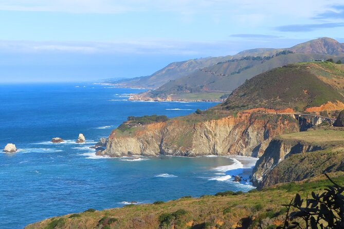
Big Sur rewards a slow eye. This self-guided drive brings the coast’s history and landmarks to life while letting you set the pace, and I especially like the offline GPS map and the freedom to stop, pause, or resume whenever you wish. At $14.99 per group of up to 15 people, it is also an unusually good value for a private road trip.
The main drawback is that the tour begins in Carmel and ends at the McWay Waterfall Trailhead, so you need your own car and a plan for the return journey. I also suggest checking current road conditions before setting out, since a past user found part of the road closed.
Key points before you drive
- The route follows Highway 1 from Carmel to McWay Waterfall, passing bridges, beaches, parks, viewpoints, and historic sites.
- Offline audio and GPS are major advantages, especially along a coast where internet service may be limited.
- The $14.99 price covers your whole group, up to 15 people, rather than charging each person separately.
- You control the timing, with a stop and resume feature that suits photo breaks, short walks, and meals.
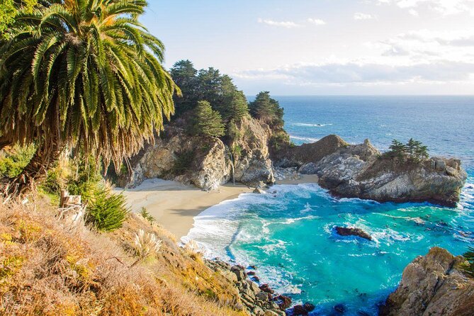
- Point Lobos, restaurants, parks, and admission fees are not included, so plan extra time and money if you want to visit them.
- The tour is in English only and uses the VoiceMap app on an Android or iOS phone.
Starting in Carmel and finding your bearings
The tour starts at Starbucks Coffee Company at 3650 Rio Road in Carmel-By-The-Sea. That gives you a clear, easy-to-find meeting point, but it is not a hotel pickup or a traditional guided departure. You need to arrive with your own vehicle, smartphone, and headphones.
The route takes about two hours to two hours and 30 minutes, according to the supplied timing. That is the approximate driving time, not necessarily the time you will spend stopping. If you pause for Point Lobos, lunch, photos, or the McWay Waterfall walk, your day will be longer.
I like this setup because you are not tied to a van or a group schedule. You can leave early, linger at a viewpoint, or pause the narration while you take pictures. The app remembers where you are, and the stop and resume feature is especially useful on a scenic road where you will not want to listen while dealing with traffic or parking.
Before leaving Carmel, download the audio, map, and geographic data through the VoiceMap app. Offline access matters here. One of the most useful details in the feedback is that the app continued to know the driver’s position even when internet service disappeared. That is exactly the sort of small feature that can save frustration on a remote coastal road.
More Self-Guided Audio Tours in the USA
- Gettysburg Battlefield Self-Guided Driving Audio Tour
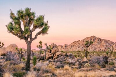
★ 4.5 · 910 reviews - Joshua Tree National Park Self-Guided Driving Audio Tour
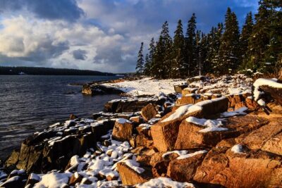
★ 4.5 · 762 reviews - Ultimate Acadia National Park Self-Guided Driving Audio Tour
★ 4.0 · 521 reviews
Point Lobos and the Carmel Highlands
The first part of the route passes Point Lobos Natural Reserve. The reserve itself is not included in the tour, so you would need to arrange any admission or visit separately. Still, the audio gives you useful orientation as you leave Carmel and enter the wilder stretch of coast.
Point Lobos is a sensible place to add time if you want a walk before continuing south. If you are trying to finish the drive within the advertised two to two-and-a-half hours, keep moving. If you have most of a day, this is one of the first places where the tour can become more than a drive-by experience.
The road then passes through the Carmel Highlands and around Yankee Point Drive. This section helps you settle into the rhythm of Highway 1. You get coastal views, tight curves, and a sense of why this road is famous, while the narration supplies background that can be easy to miss when you are focused on driving.
You should treat the audio as a companion, not a replacement for attention. Pull over safely before taking pictures, and let the app wait while you deal with traffic, parking, or a short walk.
Bridges from Malpaso Creek to Bixby Creek
The tour crosses Malpaso Creek Bridge, then continues through Garrapata State Park and over Garrapata Creek Bridge. These stops are less about one single attraction than about watching the coast change as you move south.
Garrapata State Park is one of the places where you might want to stop if time allows. The park is passed by the route, but no park admission, food, or personal expenses are included. The audio can point out the setting, yet you decide how much time to spend on the ground.
Next come Notley’s Landing viewpoint and Rocky Creek Bridge. These are useful pause points for the drive because the route is full of places that look inviting from the car but may not be obvious if you are simply following a road map. The audio helps give those places a name and a story.
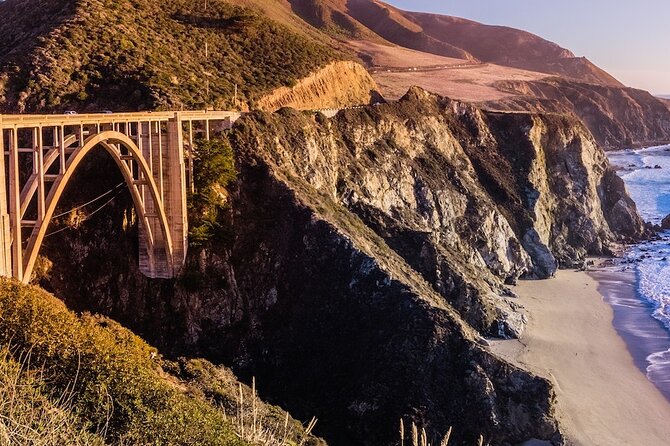
Then comes Bixby Creek Bridge, one of the signature sights on the route. It is the kind of landmark that can dominate a short visit to Big Sur, but the drive does not reduce the coast to one famous photo stop. You reach the bridge after passing several smaller viewpoints and crossings, which gives the journey a better sense of sequence.
I like that the route includes both famous and less obvious stops. One person specifically appreciated being guided to places they might not have chosen on their own. That is the best use of an audio tour: not to tell you that Bixby Bridge is attractive, but to help you notice the smaller points along the way.
Hurricane Point, Point Sur, and Andrew Molera
After Bixby Creek Bridge, the audio passes Hurricane Point, a natural place to pause for a wide coastal view. The exact amount of time you spend there is up to you, and that flexibility is important. A fixed bus tour might give you a few minutes and a whistle. Here, you can stop the recording and continue when you are ready.
The route then passes Point Sur and continues through Andrew Molera State Park. These locations add variety to the drive. You are not simply collecting bridges. The route moves between ocean views, parkland, historic points, and stretches of open road.
The tour also passes the Pfeiffer Big Sur State Park sign and crosses Pfeiffer Canyon Bridge. The park itself is not presented as an included visit, so check any fees or entry details separately if you plan to stop. The audio route can tell you where you are, but it does not provide transportation, meals, or admissions.
This is also a good point to judge your energy. If you have been stopping often, the McWay Waterfall Trailhead is still ahead. The route’s listed duration is fairly short for the number of places it passes, so a relaxed day will require extra hours beyond the basic audio playback.
More Driving Audio Tours in the USA:
- Ultimate Lake Tahoe Self-Guided Driving Audio Tour
★ 4.5 · 435 reviews - Scenic Newport, RI Self-Guided Driving Audio Tour
★ 4.5 · 325 reviews - Arches National Park Self-Guided Driving Audio Tour
★ 4.5 · 288 reviews - Yellowstone National Park Self-Guided Driving Audio Tour
★ 4.5 · 249 reviews
Nepenthe, Henry Miller, and the quieter stops
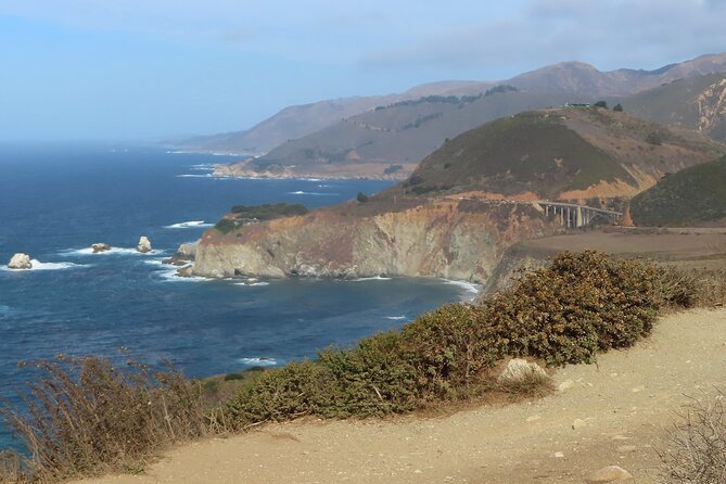
The drive passes Nepenthe restaurant, which gives you an option for a meal or a scenic break. Food and drink are not included, so you should budget separately. The tour does not promise a reservation or a guaranteed stop, but the location gives you a clear place to consider pausing.
It also passes the Henry Miller Memorial Library. That adds a cultural note to a route otherwise dominated by roads, bridges, and ocean views. You may choose to continue or investigate the site on your own, but any admission or personal expense is separate from the $14.99 tour price.
The audio continues through Grimes Canyon and past Partington Cove. These are the kinds of names that help you build a mental map of Big Sur. Without narration, you could pass them as attractive but anonymous pieces of the drive. With the app, the road has more context and structure.
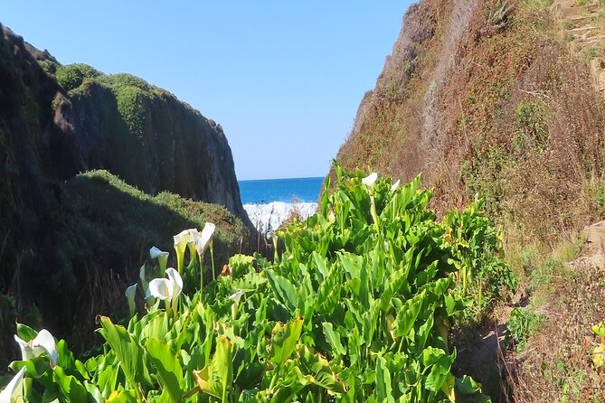
One pleasant surprise in the feedback was a stop that led to seeing lilies. That detail captures the appeal of the route. You may not know exactly which small sight will become your favorite, but the audio encourages you to look beyond the standard postcard view.
Ending at McWay Waterfall Trailhead
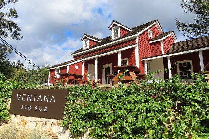
The tour ends in the parking lot for the McWay Waterfall hike, at McWay Waterfall Trail on Big Sur. This is a practical ending because it leaves you near one of the coast’s best-known short walks. The hike itself is not included as a guided activity, and the tour does not provide transportation onward.
You should think about the end point before starting. If you are driving a rental car and need to return to Carmel, you will need to arrange that yourself. If you are continuing south, the ending may fit naturally into a larger Highway 1 trip. The tour gives you a one-way route, not a round-trip transfer.
The final stop also makes the experience feel like a proper section of road rather than a loop around Carmel. You begin near town and finish well into Big Sur, having crossed bridges and passed parks, viewpoints, restaurants, and cultural sites along the way.
Why the offline feature matters
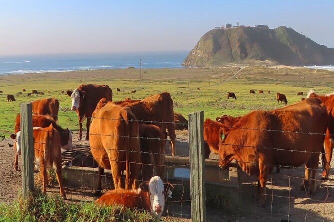
The VoiceMap app provides the audio, map, and geodata on Android and iOS. You receive lifetime access to the English tour, which is useful if you want to repeat part of the route later or pause the drive across more than one day.
The offline function is the strongest practical feature. Big Sur can be a poor place to depend on a live connection, and the GPS can still track your position after the route has been downloaded. I would still charge your phone fully, bring headphones, and download everything before leaving reliable service.
The app’s flexibility also suits different driving styles. You can listen continuously and finish near the listed time, or stop at Point Lobos, Garrapata, Nepenthe, or another place and restart when ready. You are not paying extra each time someone in your group wants a photo break.
The price and who gets the best value
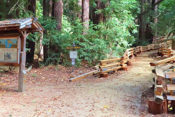
At $14.99 per group of up to 15 people, the price is low for a private experience. A couple pays the same group rate as a larger family or a group of friends, so the value improves as your party gets bigger.
You are paying for the route design, narration, mapping, and app access. You are not paying for a car, a driver, food, headphones, park entry, parking, or other personal expenses. That distinction matters. The tour is cheap because it leaves the main costs of a coastal road trip with you.
I would choose this for independent-minded visitors who want background and direction without joining a scheduled group. It also works well if you have only a few days in the area and want a clear way to experience the coast from Carmel.
I would not choose it if you want a live guide, hotel pickup, transportation, or a fully managed day. It is also less suitable if you dislike using a phone while traveling or if your group needs narration in a language other than English.
A practical way to plan the drive
Start with the app downloaded and the route open before you leave the Starbucks meeting point. Keep the audio volume low enough to hear traffic, and pause it when you park or walk.
Allow more than the advertised two to two-and-a-half hours if you want to visit a park, eat at Nepenthe, stop at viewpoints, or take the McWay Waterfall walk. The route passes many places, but passing them is not the same as visiting them.
Check road conditions before departure. One past user had to deal with a road closure, and Highway 1 conditions can change. The tour can guide you only along an open and usable route, so a quick check before leaving is sensible.
Free cancellation is available if you cancel at least 24 hours before the local start time. Changes or cancellations inside that 24-hour window are not accepted for a refund.
Should you book this Big Sur audio tour?
I would book it if you want a low-cost, flexible way to follow the coast from Carmel to McWay Waterfall Trailhead. The strongest reasons are the offline GPS, the stop and resume function, and the useful mix of famous sights and smaller stops.
I would skip it if you need return transportation, a human guide, or a short loop that brings you back to your starting point. For everyone else, this is a smart road companion. Bring your own car, download the route, allow extra time for stops, and treat the audio as a helpful voice in the passenger seat rather than a rigid schedule.
FAQ
Where does the self-guided audio tour start?
It starts at Starbucks Coffee Company, 3650 Rio Road, Carmel-By-The-Sea, California 93923.
Where does the tour end?
It ends in the parking lot for the McWay Waterfall hike at McWay Waterfall Trail, Big Sur, California 93920.
How long does the tour take?
The approximate driving time is two hours to two hours and 30 minutes. Stops, meals, park visits, and the McWay Waterfall walk can make your day longer.
How much does the tour cost?
The price is $14.99 per group, with up to 15 people included.
What language is available?
The tour is offered in English.
Does the tour include transportation?
No. You need to provide your own transportation, and the tour does not include a vehicle or driver.
Does the tour include food, drinks, or admission fees?
No. Food, drinks, personal expenses, and admission fees not included during the tour are separate.
Can I use the tour without internet service?
Yes. You can download the audio, maps, and geodata for offline use through the VoiceMap app. The GPS map is designed to keep you on track offline.
Can I cancel for a full refund?
Yes, if you cancel at least 24 hours before the experience’s local start time. Cancellations or changes made less than 24 hours in advance are not refunded.
Just added around the USA
- Self Guided Driving Audio Tour of Saguaro National Park★ 3.0 · 4 reviews
- Self-Guided Audio Driving Tour of Mount Lemmon★ 5.0 · 4 reviews
- Saguaro National Park Self-Guided Audio Tour★ 3.5 · 11 reviews
- A Self Guided Audio Tour in Tombstone★ 4.0 · 11 reviews
- Catskills Scenic Byway Self-Guided Driving Audio Tour★ 4.0 · 9 reviews
- Big Bend National Park Self Guided Audio Tour Guide★ 5.0 · 12 reviews
- Self-Guided Audio Driving Tour in Catskills Scenic Byway★ 4.5 · 7 reviews
- Shiloh Battlefield Self-Guided Driving Audio Tour★ 4.0 · 9 reviews
Driving Audio Tours, compared.

Ultimate Acadia National Park Self-Guided Driving Audio Tour
Read our review →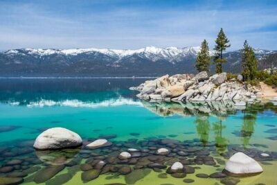


Browse the lists this tour appears in