
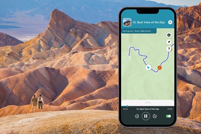
REVIEW · PALM SPRINGS AUDIO TOURS
Death Valley National Park Self-Guided Audio Tour
Death Valley rewards a slow day. I like the offline GPS narration and the freedom to stop at salt flats, dunes, canyons, and historic mining sites without joining a group. I also like the low price: $12.79 covers an entire vehicle of up to 15 people. The main drawback is the size of the route. Seeing every stop in six to eight hours would make for a rushed day, especially if you want to hike.
This is a private audio tour from Shaka Guide Apps, beginning near Death Valley Junction, with an optional start near Panamint Springs at the park’s west entrance. You download the tour before leaving strong Wi-Fi, then let the app provide automatic directions and stories as you drive. Just remember that the $12.79 price does not include your transportation or the optional $30 vehicle entrance fee.
Key points to know before you go
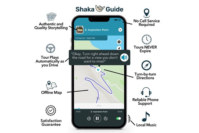
- One low price covers the whole car: Up to 15 people can use the tour, making it a strong value for families and small groups.
- No cell service is required: Download the audio, map, and GPS data before entering the park.
- The route covers major Death Valley sights: Expect dunes, salt flats, colorful rock, historic borax works, overlooks, and optional dirt roads.
- You control the pace: Pause, skip stops, return another day, or use the tour over multiple days because it does not expire.
- Hikes need extra time: Badwater Basin, Natural Bridge, Golden Canyon, and Dante’s View can turn a drive into a full day.
- Road conditions matter: Mustard Canyon and Twenty Mule Team Canyon can be bumpy and unsuitable for low-clearance vehicles.
Why this audio tour works well in Death Valley
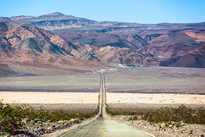
Death Valley is a difficult park to tour without planning. Distances are long, services are limited, and many sights sit far from the main road. A good audio guide earns its keep by explaining what you are seeing while also telling you where to turn, where to stop, and where to find food or fuel.
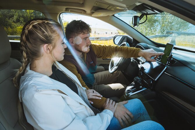
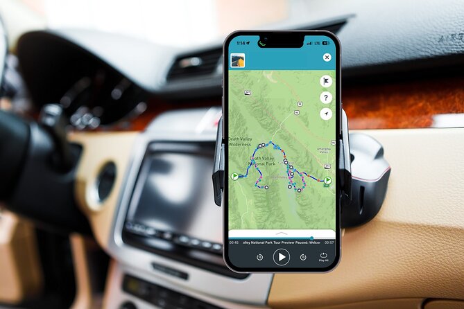
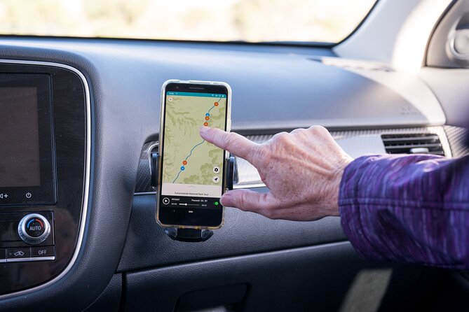
This tour uses GPS to trigger narration as you drive. You do not need to stare at your phone, and the audio continues without a data connection once the tour has been downloaded. One user found the road warnings especially useful, along with the way the app picked up the starting location automatically.
I would still download everything at home or at your hotel. The park’s remote stretches are no place to troubleshoot an app. The tour works in English, and the narration includes stories, music, directions, activity suggestions, and restaurant tips.
The private format is another real benefit. You are not keeping pace with a bus or waiting for a guide to gather a group. You can stop for five minutes at a historic site or spend an hour on a hike. If one person wants photographs and another wants to keep moving, the decision stays inside your car.
More Self-Guided Audio Tours in the USA
- Gettysburg Battlefield Self-Guided Driving Audio Tour
★ 4.5 · 910 reviews - Joshua Tree National Park Self-Guided Driving Audio Tour
★ 4.5 · 762 reviews - Ultimate Acadia National Park Self-Guided Driving Audio Tour
★ 4.0 · 521 reviews
From Death Valley Junction to the Panamint Range
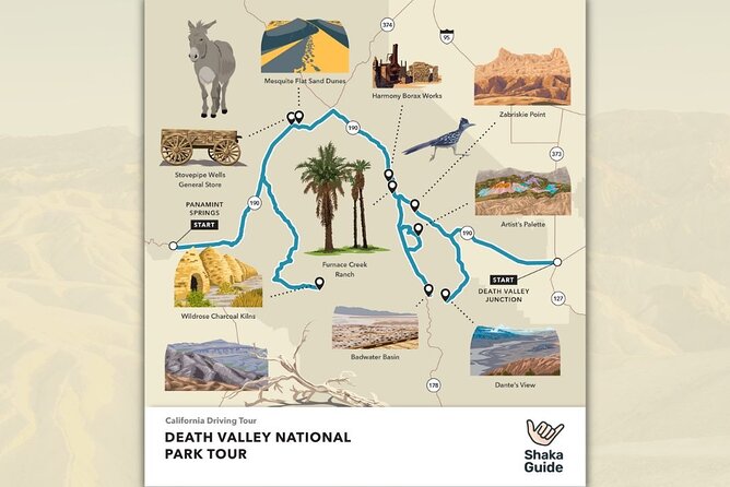
The stated starting point is Death Valley Junction, California. There is also an optional starting point near Panamint Springs at the park’s west entrance. That flexibility helps if you are approaching from different directions, but you should select the correct starting point in the app before setting off.
The first optional section heads up Emigrant Canyon Road toward the Wildrose Charcoal Kilns. This is not the quickest way through the park, so treat it as a history and photography detour rather than a required part of the day.
Journigan’s Mill
Journigan’s Mill has little left of the former early twentieth-century processing plant. You will see foundations, empty tanks, and scattered industrial remains. I would give this stop ten minutes if you enjoy old mining sites or stark photographs.
It is not a major visual attraction. If your time is tight, this is one of the easier stops to skip. For anyone interested in how people tried to work in such a harsh setting, the ruins add useful context.
Wildrose Campground
The old Wildrose Campground was connected with the Civilian Conservation Corps. Remaining buildings sit close to the road, making this a simple place to stretch your legs during the long drive toward the kilns.
The suggested stop is only five minutes. That sounds brief, but it is enough to walk through the surviving structures and break up the drive.
More National Park Audio Tours in the USA:
- Arches National Park Self-Guided Driving Audio Tour
★ 4.5 · 288 reviews - Yellowstone National Park Self-Guided Driving Audio Tour
★ 4.5 · 249 reviews - Self-Guided GPS Audio E-Bike Tour Hawaii Volcanoes National Park
★ 4.5 · 131 reviews - Shenandoah National Park Self-Guided Driving Audio Tour
★ 4.5 · 109 reviews
Charcoal Kilns
The ten beehive-shaped charcoal kilns are the real prize in this detour. They sit high in the Panamint Range in a neat row, with thick masonry walls and dark openings. You can step inside one, and you might still notice the smell of charcoal.
This stop is short but memorable. The kilns are unusual enough to justify the detour for many people, though you should allow extra driving time beyond the ten-minute visit.
Stovepipe Wells, sand dunes, and a desert wetland
Stovepipe Wells Village
Stovepipe Wells is one of the few places in the park with visitor services, lodging, food, and fuel. If you need a meal or gasoline while inside Death Valley, this is one of the practical stops to consider.
Prices are higher in the park, so do not treat this as a bargain break. Still, stopping here can save you from pushing on with an empty tank or a hungry carload.
Mesquite Flat Sand Dunes
Mesquite Flat is the only dune area included on this route. You can admire the dunes from the parking area, but I think the better choice is to walk out among them and the mesquite trees.
The suggested visit is 15 minutes, which is enough for a quick look but not much more. The dunes are especially well suited to sunset and stargazing, so you may want to return later rather than squeeze them into the middle of a hot afternoon.
Devils Cornfield
Near the dunes, arrowweed grows in clumps that resemble rows of corn. The Devils Cornfield has a small parking area, making it easy to pull over and inspect this odd plant formation.
This is a five-minute curiosity, not a major destination. I would combine it with Mesquite Flat rather than plan a separate outing.
Salt Creek Interpretive Trail
Salt Creek offers one of the park’s most surprising changes of scene. A half-mile boardwalk crosses a wetland that supports the endangered Salt Creek Pupfish and provides water for desert wildlife.
The trail is easy, but the access road is dirt. Allow about 15 minutes for the listed stop, though you may want longer if you enjoy watching for signs of life in an otherwise dry setting. This is a good reminder that Death Valley is not simply a place of bare salt and rock.
Borax history and Furnace Creek services
Harmony Borax Works
Harmony Borax Works presents the remains of an early mining operation along a short interpretive path. Placards explain the buildings and equipment used to process borax, and you can see one of the wagons associated with the famous twenty-mule teams.
This is one of the best stops for understanding the human side of Death Valley. The suggested 15 minutes is enough to read a few signs and see the wagon, but history fans may want more time.
Furnace Creek Visitor Center
The Furnace Creek Visitor Center is worth a proper stop, not just a quick look at the building. You can get current information, use flush toilets, refill water, and visit a museum covering the park’s natural and human history.
The tour allows 30 minutes here. I would treat that as a minimum if you need road updates or want to study the displays. Death Valley conditions change, and the visitor center is the sensible place to ask about dirt roads before driving them.
The Ranch at Death Valley
Furnace Creek is the park’s main place for a full meal and gasoline. The Ranch includes an ice cream parlor, buffet-style restaurant, Wild West-themed saloon, General Store, grocery items, and the Borax Museum.
Expect higher prices than outside the park. The advantage is convenience, not savings. If you need fuel, food, or a cold treat, this is where the route becomes particularly practical.
The salt floor, Natural Bridge, and Artists Drive
Devil’s Golf Course
A short dirt road leads to the Devil’s Golf Course, where salt has formed jagged, otherworldly shapes. There is no defined walking trail, and sturdy shoes are important because the rough salt can hurt your feet.
The listed stop is ten minutes. I would keep your footing in mind and avoid wandering farther than you can safely manage. This is a quick viewpoint with a strong visual payoff.
Badwater Basin
Badwater Basin is the central event of a Death Valley visit. At the lowest point in North America, the salt floor stretches toward the surrounding mountains, creating one of the park’s most recognizable views.
A boardwalk begins near the parking area, but you can walk farther onto the basin. The striking geometric salt patterns are about one mile from the parking area, making the full walk roughly two miles round trip.
The suggested stop is 30 minutes, but that timing only works for a short visit. If you want to reach the salt formations, take more time and carry water. The basin can turn a quick stop into a proper walk.
Natural Bridge Trail
The Natural Bridge Trail is about one mile round trip. It is flat but rocky, leading to a natural bridge formation in the desert.
This is a manageable hike for people who want something more active than roadside viewpoints. Allow at least the recommended 30 minutes, and wear shoes suited to uneven ground.
Artists Drive and Artists Palette
Artists Drive is a one-way road winding through a tight canyon in the Black Mountains. The drive itself is part of the attraction, but Artists Palette is the key stop.
Minerals in the rock create bands of color on the cliffs. You can get out and walk closer for a better look. The road is more engaging than a simple pull-off, though its one-way layout means you should follow the route carefully and allow the full 30 minutes.
Golden Canyon, Zabriskie Point, and two rougher roads
Golden Canyon Trailhead
Golden Canyon is one of the route’s best choices for hikers. The trail passes through a stark canyon toward the Red Cathedral formation, with a round trip of about three miles.
The suggested visit is one hour. That may work for a quick, steady hike, but you should not feel pressured to finish the trail if conditions are hot or you would rather see more of the park. The audio tour gives you flexibility, so use it.
Zabriskie Point
Zabriskie Point offers one of Death Valley’s classic views, including Red Cathedral and Manly Beacon. The overlook is also tied to film history and U2’s Joshua Tree album cover.
The walk from the parking lot is short and paved, but steep. Plan for about 20 minutes, and save extra time for photographs. This is an easy stop to understand, but it is one of the places where a few extra minutes pay off.
Twenty Mule Team Canyon
Twenty Mule Team Canyon is a roughly 15-minute detour on a dirt road through tight curves and unusual rock formations. There is no single formal stop, so the appeal comes from the drive itself.
Check current road conditions before entering. In normal conditions the road is reasonably maintained, but it is bumpy and not suitable for low-clearance vehicles. The same warning applies to Mustard Canyon, a small yellow-tinged canyon reached by another rough road.
Dante’s View
Dante’s View rises more than 5,000 feet above Badwater Basin. From the overlook, you can see the lowest point in North America, the Panamint Range, and, on clear days, the Sierra Nevada and Mount Whitney.
The recommended stop is 30 minutes, but the timing depends on light and weather. This is a strong sunset and stargazing location. It also gives you a useful sense of Death Valley’s enormous scale after spending the day at the valley floor.
Price, timing, and practical value
At $12.79 per group, the value is excellent if you have several people in one vehicle. A group of four pays far less per person than it would for a traditional guided excursion. The tour also never expires, so you can split the route across more than one day.
The real cost is your time, fuel, park entrance fee, and food. The optional entrance charge is $30 per vehicle, and meals and refreshments are extra. You also need your own car, since transportation is not included.
The route contains enough stops and hikes to fill a full day, and possibly more. I would not try to complete every detour, museum, hike, and sunset viewpoint in six hours. Pick your priorities before you start:
- For scenery, choose Mesquite Flat, Badwater Basin, Artists Palette, Zabriskie Point, and Dante’s View.
- For history, choose Harmony Borax Works, Journigan’s Mill, Wildrose, and the Charcoal Kilns.
- For hiking, allow extra time at Badwater Basin, Natural Bridge, and Golden Canyon.
- For practical needs, plan fuel, food, water, and restrooms at Stovepipe Wells or Furnace Creek.
The audio can play through your car speakers. One creative setup used Shokz headphones while walking and an AirFly adapter to send sound to two Bluetooth headsets. That is not required, but it may help if people in the car want different audio arrangements.
Who should book this Death Valley tour?
I recommend it for independent visitors who want more context than a paper map provides but do not want a fixed group schedule. It is especially useful for families, couples, and small groups sharing one car.
It is less suitable if you want a human guide answering questions in real time, or if you plan to spend most of the day on long hikes. The audio works best while driving, and one area for improvement is the amount of information available once you are standing at a stop.
The tour has a 4.4 rating from five reviews, with the strongest praise focused on offline operation, automatic location detection, road warnings, flexibility, and clear narration. Those are exactly the features that matter in Death Valley.
Book it if you want a low-cost guide that handles directions and background stories while you drive. Skip it if you already have a detailed plan and prefer complete silence, a personal guide, or a hike-first day. For most self-directed park visits, it is a useful companion, as long as you download it early and leave room in your schedule.
Free cancellation is available up to 24 hours before the start time. Cancellations within 24 hours are not refunded.
FAQ
How much does the Death Valley audio tour cost?
The tour costs $12.79 per group, with up to 15 people included. The price does not include transportation, the optional $30 per vehicle park entrance fee, meals, refreshments, parking fees, or other entrance charges.
How long does the tour take?
The estimated duration is six to eight hours. If you hike at Badwater Basin, Natural Bridge, or Golden Canyon, or add the Wildrose and dirt-road detours, you may need more time.
Does the tour work without cell service?
Yes. Download the audio tour, offline map, and GPS information using strong Wi-Fi before you go. The tour is designed to work without continuous Wi-Fi or mobile data.
Where does the tour start?
The main starting point is Death Valley Junction, California. An optional starting point is available near Panamint Springs at the west entrance of Death Valley National Park.
Can I skip stops or pause the tour?
Yes. You can pause, resume, skip stops, and explore at your own pace. The tour does not expire, so you can also use it over multiple days.
Is transportation included?
No. You need your own private transportation. The tour is designed to provide audio narration and GPS directions for the vehicle you use.
Is the tour available in languages other than English?
The tour is offered in English.
Just added around the USA
- Self Guided Driving Audio Tour of Saguaro National Park★ 3.0 · 4 reviews
- Self-Guided Audio Driving Tour of Mount Lemmon★ 5.0 · 4 reviews
- Saguaro National Park Self-Guided Audio Tour★ 3.5 · 11 reviews
- A Self Guided Audio Tour in Tombstone★ 4.0 · 11 reviews
- Catskills Scenic Byway Self-Guided Driving Audio Tour★ 4.0 · 9 reviews
- Big Bend National Park Self Guided Audio Tour Guide★ 5.0 · 12 reviews
- Self-Guided Audio Driving Tour in Catskills Scenic Byway★ 4.5 · 7 reviews
- Shiloh Battlefield Self-Guided Driving Audio Tour★ 4.0 · 9 reviews
National Parks, compared.
Ultimate Acadia National Park Self-Guided Driving Audio Tour
Read our review →
Vesuvius National Park Skip-The-Line Ticket and Audio Guide
Read our review →
Self-Guided GPS Audio E-Bike Tour Hawaii Volcanoes National Park
Read our review →
Browse the lists this tour appears in