

REVIEW · USA AUDIO TOURS
Cape Hatteras National Seashore Self-Guided Audio Driving Tour
Let the road tell you its stories. This Cape Hatteras audio tour turns a long Outer Banks drive into a guided history lesson, with tales of hurricanes, shipwrecks, pirates, lighthouses, wildlife, and life-saving crews. I like the location-triggered narration, which starts as you reach each point, and the one-price-per-car format, which costs $14.99 for up to four people.
The biggest consideration is time. The route covers more than 59 miles and includes over 49 audio stories. The basic estimate says two to three hours, but a relaxed trip with beach stops, photos, and side visits can take four to six hours. You need a phone, a strong connection for the initial download, and a driver who can keep the app running safely.
Key points to know before you go
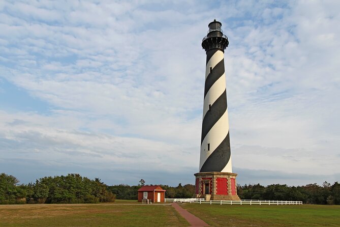
- Oregon Inlet begins the story: Learn how a hurricane created this major water passage in 1846.
- More than 59 miles of narration: The route follows the Outer Banks from the Nags Head area toward Hatteras.
- Forty-nine-plus audio stories: The tour covers shipwrecks, wildlife, bridges, lighthouses, pirates, and local traditions.
- Pause whenever you like: Stop for a beach walk, lunch, photos, or a side trip, then pick up where you left off.
- $14.99 covers up to four people: That is a strong value for a family or small group sharing one car.
- Download before leaving good service: Once installed, the route and audio work offline.
What this Outer Banks audio tour actually does
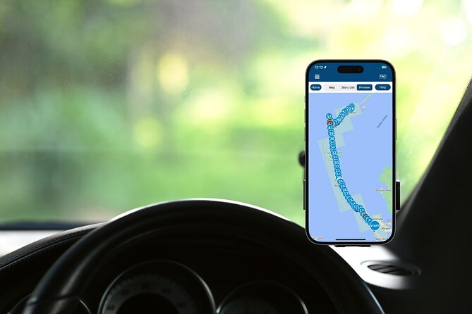
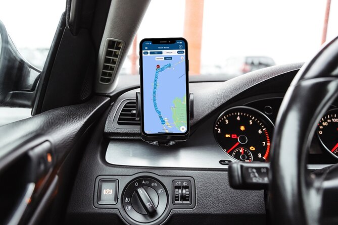
This is not a bus excursion or a walking tour with a person waiting at the first stop. It is a private, self-guided driving experience from Travel with Action. You make your own way to the starting point on Cape Hatteras National Park Road near Nags Head, open the Action Tour Guide app, and let the GPS trigger each story.
That format fits the Outer Banks well. The national seashore is spread along a narrow strip of barrier islands, and many points of interest are separated by long stretches of road. A standard guidebook can tell you what you are seeing, but it cannot always tell you when to look to the right, when a bridge has a surprising backstory, or why a plain stretch of sand matters.
The narration is designed to play automatically as you approach each location. You do not need to keep checking a map or tap a new track every few minutes. You can also pause the audio, skip a story, or stop for a break without losing your place.
The route ends at 59200 Museum Drive in Hatteras. You can use the tour in one day, spread it over several days, or save it for another visit because access does not expire. That lifetime access is especially useful if your first trip is slowed by beach time or poor weather.
More Self-Guided Audio Tours in the USA
- Gettysburg Battlefield Self-Guided Driving Audio Tour
★ 4.5 · 910 reviews - Joshua Tree National Park Self-Guided Driving Audio Tour
★ 4.5 · 762 reviews - Ultimate Acadia National Park Self-Guided Driving Audio Tour
★ 4.0 · 521 reviews
Oregon Inlet and the start of the Graveyard of the Atlantic
The first major story comes at Oregon Inlet, the waterway connecting Pamlico Sound with the Atlantic Ocean. It did not exist until a powerful hurricane opened it in 1846. The story becomes even more memorable with the tale of the ship Oregon, which was reportedly lifted by storm water and placed safely on a sandbar.
That opening gives you the tone of the route. This is not only a drive past pretty beaches. The coastline keeps changing, sometimes through slow movement of sand and sometimes through sudden storms that redraw the map.
The Herbert C. Bonner Bridge carries the road over the inlet. Built in 1963, it gives you a broad view of Pamlico Sound. The water is about 80 miles long and 18 miles wide, yet reaches no more than 26 feet in depth. Rivers from the mainland feed the sound, creating the second-largest estuary in the United States after Chesapeake Bay.
The audio makes this water useful to picture, not just pretty to look at. Pamlico Sound supports major commercial fishing, including crabs, oysters, and clams. The route explains that about 90 percent of North Carolina’s commercial fishermen work these waters.
I recommend listening closely as you cross the bridge, but do not try to study the screen while driving. The app is meant to be hands-free. If you want photos, pull over at a safe place.
Oregon Inlet Life-Saving Station and the coast’s dangerous past
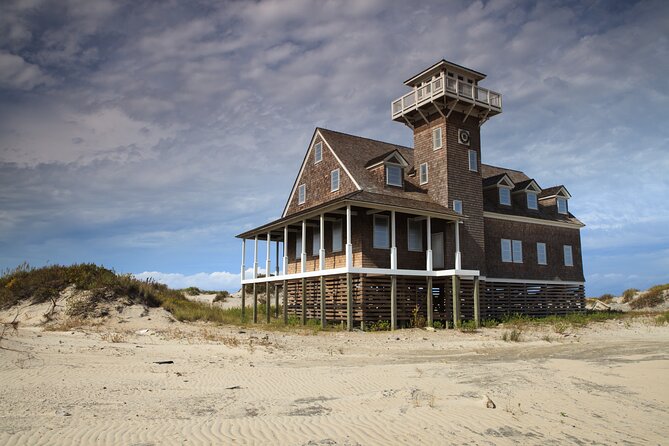
Near the point where the bridge meets land, look for the Oregon Inlet Life-Saving Station, built in 1874. It is a reminder of how exposed this coast was before modern navigation equipment.
The old rescue crews had no radar, GPS, or sonar. Sailors approaching the inlet at night had to find their way through shifting sand, rough water, and limited visibility. Shipwrecks were so common that the Outer Banks became known as the Graveyard of the Atlantic.
This is one of the tour’s strongest themes. The beach may look peaceful, but the same currents and shallow waters that attract fishermen once threatened nearly every ship passing nearby. The audio connects the scenery to the people who watched it, worked it, and sometimes risked their lives along it.
Pea Island National Wildlife Refuge and the Atlantic Flyway
The route then enters the 13-mile Pea Island National Wildlife Refuge, stretching from the southern side of Oregon Inlet toward Rodanthe. Here, the focus shifts from storms and wrecks to birds and coastal habitat.
The refuge lies along the Atlantic Flyway, a major migration route used by birds moving up and down the eastern coast. The narration compares the refuge to a rest stop in the sky. That simple image helps you understand why a narrow band of beach can matter far beyond its size.
Pea Island Beach offers a good place to stop. The beach is popular, but its size gives you room to appreciate the view without feeling boxed in. You do not need to swim to enjoy the pause. Sitting on the sand for a few minutes breaks up the drive and gives the audio route a more natural rhythm.
This is one reason I would not rush the tour into its shortest possible time. The point is not merely to collect audio stops. The best use of the app is to let it guide your attention, then give yourself time to look around.
More Driving Audio Tours in the USA:
- Ultimate Lake Tahoe Self-Guided Driving Audio Tour
★ 4.5 · 435 reviews - Scenic Newport, RI Self-Guided Driving Audio Tour
★ 4.5 · 325 reviews - Arches National Park Self-Guided Driving Audio Tour
★ 4.5 · 288 reviews - Yellowstone National Park Self-Guided Driving Audio Tour
★ 4.5 · 249 reviews
Jug Handle Bridge and the practical side of barrier islands
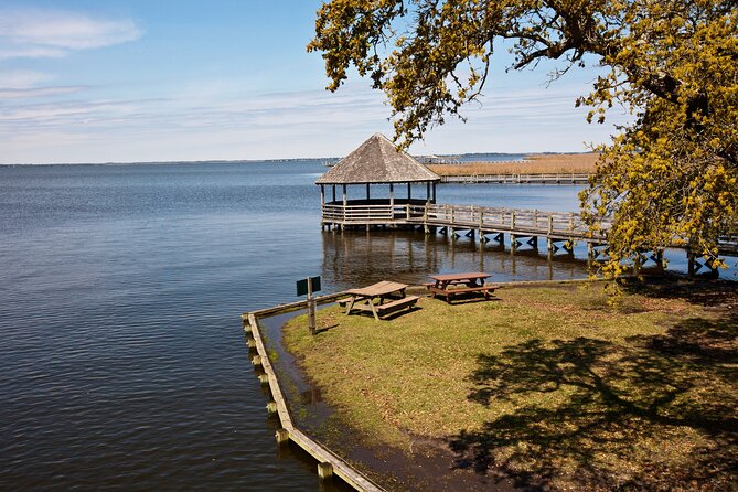
The Jug Handle Bridge is an unusual piece of road engineering. You are driving beside the island, not simply crossing from one island to another, so the bridge may seem unnecessary at first.
The audio explains why the structure exists and gives you a useful reminder that Outer Banks travel is shaped by water, sand, and limited room. Roads here cannot always follow the most direct-looking line. Bridges, curves, and raised sections help keep the main route moving through a fragile and changeable setting.
This is a good example of the tour’s value. A bridge can pass in seconds if you are driving alone. With a short story attached to it, that same structure becomes part of the region’s identity.
Chicamacomico Life-Saving Station and beach rescue history
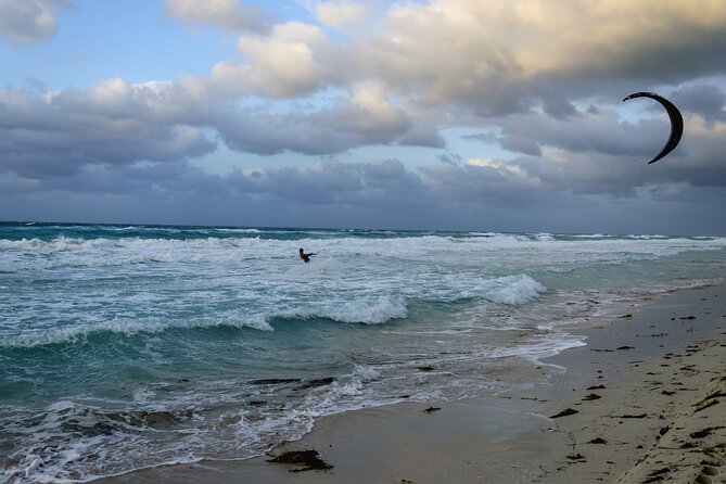
At Chicamacomico, another historic life-saving station appears on the route. Like the Oregon Inlet station, it served as a base for crews who watched the coast, lived nearby, and trained for rescues.
The narration introduces the beach apparatus, an unusual device used in earlier rescue work. You get a sense of how much effort was required to reach a ship in trouble before motorized rescue boats and modern communications became common.
For history-minded visitors, this may be one of the most rewarding stops. It shows that the Outer Banks story is not only about famous lighthouses and pirates. It is also about ordinary crews who practiced, waited, and responded when ships ran aground.
The tour does not include entry tickets or attraction reservations. If you want to visit a museum or historic site along the route, admission is separate. That is worth remembering when you plan your budget and schedule.
Coquina Beach, Bodie Island Lighthouse, and shifting sand

The route also brings attention to Coquina Beach and the Bodie Island Lighthouse. Coquina Beach takes its name from the small coquina clams found along the shore, though its most notable story concerns an old shipwreck.
The lighthouse adds another layer to the route’s theme of difficult coastal conditions. The audio contrasts Bodie Island Lighthouse with Cape Hatteras Lighthouse later in the drive, using their construction problems and early challenges to show how hard it was to build lasting towers on shifting coastal ground.
The tour is useful here because it gives you context before you arrive. Without that background, a lighthouse can look like a photograph stop. With the story playing, you start thinking about why it was built, what danger it was meant to prevent, and how the coast shaped its design.
Roanoke Island and the 400-year-old Mother Vine
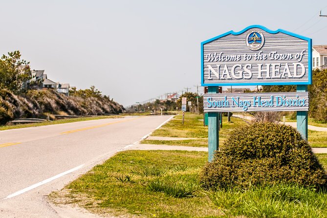
One of the more unusual stories concerns the Mother Vine on Roanoke Island. This grapevine is about 400 years old and is considered the oldest grapevine on the continent that still produces grapes.
It is a welcome change of pace from shipwrecks and hurricanes. The Mother Vine connects the area to early settlement, agriculture, and the long passage of time. The exact date of its origin is not known, which makes the story more curious rather than less useful.
Because this point relates to Roanoke Island, check the route and audio directions carefully. The main drive follows the Outer Banks toward Hatteras, and the Mother Vine may work better as a related stop or side excursion depending on your chosen tour direction. The app’s map and story cues should guide your decision.
Kite Point and the modern Outer Banks
At Kite Point, the tour shifts from old rescue stations to modern water sports. This sandy area has become a favorite place to watch kitesurfing, while nearby beaches have attracted windsurfers since the 1970s.
The narration explains where kitesurfing came from and why the local wind and water conditions suit it. Even if you have no interest in trying the sport, it is fun to watch from shore. The speed and bright kites bring a different energy to a route otherwise filled with old ships and historic structures.
This stop also shows that the Outer Banks is not frozen in the past. The same wind that once made sailing and rescue work difficult now draws people to the water for recreation.
Cape Hatteras Lighthouse, the route’s landmark stop
Cape Hatteras Lighthouse is likely to be the visual centerpiece of the drive. The audio recalls the earlier discussion of Bodie Island Lighthouse and then explains that Cape Hatteras had its own difficult beginning.
The famous black-and-white spiral tower is closely tied to the danger of Diamond Shoals and the heavy ship traffic that once passed offshore. The tour gives you a reason to pay attention to the lighthouse beyond its striking appearance.
You should allow extra time here if you plan to visit the site. The tour itself does not include admission, reservations, or attraction passes. It provides the story and directions, while you decide how long to stay.
Teach’s Lair Marina and the legend of Blackbeard
Near the end of the route, Teach’s Lair Marina brings pirates into the story. The name refers to Edward Teach, better known as Blackbeard, whose presence still appears in local place names and stories.
The marina is identified by the collection of boats to the right as you approach. This kind of cue is helpful because it tells you exactly what to watch for without forcing you to search the map while driving.
Blackbeard’s connection gives the final portion of the route a lively finish. After hearing about storms, fishermen, wildlife, lighthouses, and rescue crews, you arrive at a place linked to one of the coast’s most famous pirates.
Timing, app setup, and how to get the best value
The official duration information gives two different expectations. You may complete the core drive in about two to three hours, but the full route covers more than 59 miles, includes over 49 stories, and can take four to six hours when you stop at beaches, viewpoints, and attractions.
I would plan for at least half a day. If you want to explore Cape Hatteras Lighthouse, walk on Pea Island Beach, or visit a museum, give yourself more time. The tour has no expiry, so there is no reason to force every stop into one rushed outing.
Before you go, download the separate Action Tour Guide app while you have strong Wi-Fi or cellular service. You receive setup instructions and a password by email and text. Search for audio tour if the messages are hard to find.
Once the route is downloaded, it works offline. Connect your phone to the car with Bluetooth, USB, or AUX. Apple CarPlay works with audio playback, while Android Auto support is still being developed according to the supplied information. An iPhone running iOS 15 or later, an Android device running version 9 or later, or an iPad or tablet with GPS and cellular service is recommended.
The tour is sold per group, not per person. At $14.99 for up to four people, the value is strongest when a family or group shares one car. It is far less costly than arranging a private guide, though you do not get live questions, personal conversation, or help changing the route.
Who should book this tour
I would choose this tour if you like road trips, local history, wildlife stories, and the freedom to set your own pace. It is especially useful for first-time visitors who want more meaning from the long drive between Nags Head and Hatteras.
Families may appreciate the short stories and flexible stops. Couples and small groups can use it as a shared soundtrack for the drive. It also suits repeat visitors who want to explore at a different pace because the access never expires.
I would hesitate if you want a live guide, a tightly scheduled sightseeing program, or a tour limited to one famous lighthouse. The route is long, and the app cannot replace checking road conditions, parking rules, or attraction hours yourself.
Cancellation is free if you cancel at least 24 hours before the start time. Changes or cancellations within 24 hours are not refunded.
Should you book the Cape Hatteras audio tour?
Book it if you want freedom, strong value, and useful stories tied to the road in front of you. The best parts are the automatic narration, the flexibility to pause, and the wide range of subjects, from Oregon Inlet and Pamlico Sound to Pea Island, life-saving stations, kitesurfing, Blackbeard, and the lighthouses.
Skip it if you prefer a person beside you or if your schedule allows only a quick drive through. For most visitors with a car and half a day, $14.99 buys a practical companion that helps turn a scenic route into a memorable one.
FAQ
How much does the Cape Hatteras audio driving tour cost?
The tour costs $14.99 per group, with up to four people included in one purchase.
How long does the tour take?
The basic estimate is two to three hours. The full route covers more than 59 miles and has over 49 audio stories, so allowing four to six hours gives you time for beaches, photos, and other stops.
Where does the tour start?
The starting point is on Cape Hatteras National Park Road near Nags Head, North Carolina.
Where does the tour end?
The listed ending point is 59200 Museum Drive in Hatteras, North Carolina.
Does the tour work without cell service?
Yes. You must download the tour while you have strong Wi-Fi or cellular service. After that, the audio and maps work offline.
Does anyone meet you at the starting point?
No. This is a self-guided activity. You open the Action Tour Guide app at the starting point, and the first story begins automatically when you reach its location.
Can I use the tour more than once?
Yes. Access does not expire. You can use it on another trip, pause it, return to it later, or spread the drive across multiple days.
Just added around the USA
- Self Guided Driving Audio Tour of Saguaro National Park★ 3.0 · 4 reviews
- Self-Guided Audio Driving Tour of Mount Lemmon★ 5.0 · 4 reviews
- Saguaro National Park Self-Guided Audio Tour★ 3.5 · 11 reviews
- A Self Guided Audio Tour in Tombstone★ 4.0 · 11 reviews
- Catskills Scenic Byway Self-Guided Driving Audio Tour★ 4.0 · 9 reviews
- Big Bend National Park Self Guided Audio Tour Guide★ 5.0 · 12 reviews
- Self-Guided Audio Driving Tour in Catskills Scenic Byway★ 4.5 · 7 reviews
- Shiloh Battlefield Self-Guided Driving Audio Tour★ 4.0 · 9 reviews
Driving Audio Tours, compared.



Ultimate Acadia National Park Self-Guided Driving Audio Tour
Read our review →



Browse the lists this tour appears in