
REVIEW · SAN FRANCISCO AUDIO TOURS
Point Reyes National Seashore Self Guided Driving Audio Tour
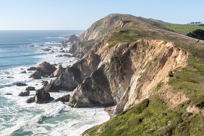
The lighthouse is only part of the story. This self-guided drive turns Point Reyes National Seashore into a narrated coastal journey, with more than 53 audio stories spread across a route of over 21 miles. I like the freedom to stop for beaches, walks, and photos, and I like the price: $16.99 covers a whole car of up to four people. The main drawback is the app setup, which can confuse you if you do not download and test it before arriving.
I also like that the narration points out places you could easily miss, including the Cypress Tree Tunnel and the historic KPH Radio station. The GPS-triggered audio keeps your hands free while you drive. Still, you need to pay close attention to the route, since the audio may replay when you pass the same spots again on the way back from the lighthouse.
For the best experience, download the tour on strong Wi-Fi or cellular service, connect your phone to the car stereo, and start near the Bear Valley Visitor Center Access Road. No guide meets you there, so a few minutes of preparation will save you a lot of frustration.
Key Points to Know Before You Go
- The route covers more than 21 miles: Plan on about two to three hours before adding time for hikes, beach stops, and photographs.
- The tour begins near Bear Valley: The start point is 1 Bear Valley Visitor Center Access Road, not inside the visitor center itself.
- The Cypress Tree Tunnel is easy to miss: The trees lead to the former KPH Radio station and make one of the most memorable short stops along the drive.
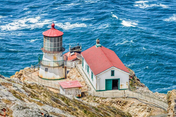
- The lighthouse is the finishing point: The tour ends at the Lighthouse Visitor Center, 27000 Sir Francis Drake Boulevard.
- The $16.99 price covers your car: Up to four people can use one purchase, making it cheaper than paying per person for a guided outing.
- The app works offline: Download the tour before you arrive, then follow the GPS-triggered stories without cellular service.
What This Point Reyes Audio Tour Actually Does
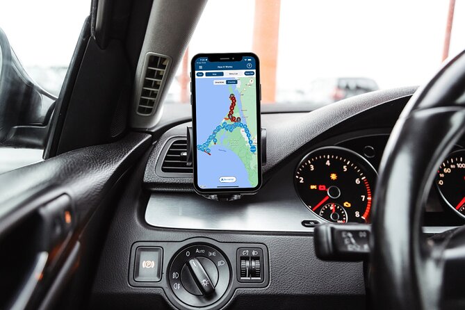
This is not a bus tour or a guided walk. You drive your own car, follow the route, and listen as the Action Tour Guide app starts stories based on your location.
That format suits Point Reyes well. The peninsula is spread out, and its best sights are separated by long stretches of open road. Instead of reading a sign at each stop or researching every turn yourself, you get short explanations about the coast, wildlife, shipwrecks, ranching, radio communication, and the people who worked here.
The narration is designed to play automatically. You can pause it for lunch, stop for a walk, or skip a story that does not interest you. You can also use the tour over several days because access does not expire.
The tradeoff is that this is a technology-based experience. If your phone is not set up correctly, the tour cannot help you much. Download the separate Action Tour Guide app, enter the password sent by email and text, and make sure the tour is loaded before you leave reliable service.
More Self-Guided Audio Tours in the USA
- Gettysburg Battlefield Self-Guided Driving Audio Tour
★ 4.5 · 910 reviews - Joshua Tree National Park Self-Guided Driving Audio Tour
★ 4.5 · 762 reviews - Ultimate Acadia National Park Self-Guided Driving Audio Tour
★ 4.0 · 521 reviews
Starting at Bear Valley, Not Inside the Visitor Center
The official starting point is the Bear Valley Visitor Center Access Road in Point Reyes Station. This detail matters because the tour is not affiliated with the visitor center, and the staff there may not know how to troubleshoot it.
Drive toward the parking area and watch for the first story to trigger as you pass the starting point. Nobody will meet you, hand you a map, or give a live introduction. The app is your guide.
I recommend setting up before you pull away. Use a phone running iOS 15 or later, Android version 9 or later, or an iPad or tablet with GPS and cellular capability. Bluetooth, USB, and AUX connections can send the narration through your car speakers. Apple CarPlay is supported, while Android Auto support is still being added.
The route works best when you follow the suggested direction and speed. If you turn around and drive through the same GPS points, some stories can play again. That is not a serious problem, but it explains why the return trip may feel less polished than the drive out.
Tomales Point and the Peninsula’s Open Coast
The first major option is Tomales Point, a remote and windswept part of the peninsula. The detour takes about 45 minutes round trip, not counting time to walk around or take pictures.
This is a good choice if you want a more open coastal setting and have extra time. It is not a quick roadside photo stop, so do not squeeze it in if you have a fixed schedule for the lighthouse.
The audio helps place Tomales Point within the larger story of Point Reyes. You are not simply driving toward a famous lighthouse. You are seeing how large and exposed this peninsula is, with beaches and ocean views spread far beyond the main route.
Drakes Estero and the 2.5-Mile Walking Option
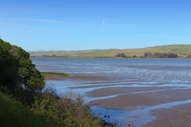
The route then points out Drakes Estero, a marshy inlet with a 2.5-mile round-trip trail. A footbridge crosses the bay, and the walk passes through coastal grasslands.
The tour identifies the Drakes Estero Trailhead and tells you when to turn left. If you are not hiking, continue driving. This simple instruction is useful because it lets you decide on the spot instead of committing to every suggested detour.
Allow more than the listed audio time if you plan to walk. The tour stop itself is brief, but the trail will change the pace of your day. I would choose this option if you want movement and quieter scenery, while skipping it if the lighthouse and wildlife viewpoints are your main goals.
More Driving Audio Tours in the USA:
- Ultimate Lake Tahoe Self-Guided Driving Audio Tour
★ 4.5 · 435 reviews - Scenic Newport, RI Self-Guided Driving Audio Tour
★ 4.5 · 325 reviews - Arches National Park Self-Guided Driving Audio Tour
★ 4.5 · 288 reviews - Yellowstone National Park Self-Guided Driving Audio Tour
★ 4.5 · 249 reviews
The Cypress Tree Tunnel and KPH Radio Station
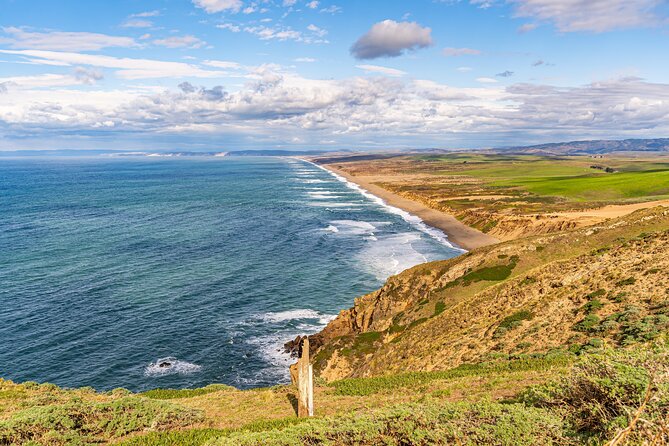
The Cypress Tree Tunnel is one of the most rewarding stops because it feels unexpected. Point Reyes is known for exposed coastline and open fields, so the rows of cypress trees seem almost out of place.
The trees lead toward the historic KPH Radio station. In the early 1900s, Morse code stations were built along the United States coast so ships could communicate with shore. The Radio Corporation of America selected Point Reyes as one of its locations, and the station was built in 1929.
The cypress rows were planted to respect the setting around the station. That small detail gives the stop more meaning. You are seeing both a communications site and an attempt to make a working facility fit its surroundings.
This is also a stop you might miss without clear directions. The audio points it out before you reach it, so keep listening and watch the roadside.
Point Reyes Beach and Drakes Beach
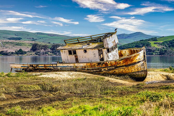
Point Reyes Beach stretches for 11 miles and faces the open ocean. The narration highlights its broad sand and ocean views, along with reports of gray whale sightings during winter and spring.
You should treat the whale information as a seasonal possibility, not a promise. The beach is worth the stop even if you see no wildlife. It gives you a sense of the peninsula’s scale and the power of the ocean-facing coast.
Drakes Beach offers a different setting. It faces Drakes Bay, so the water is more sheltered from strong winds and heavy surf than the open ocean side. White sandstone cliffs provide the backdrop.
I like the contrast between these two beaches. Point Reyes Beach shows the exposed edge of the peninsula, while Drakes Beach feels more protected. If you have limited time, choose based on your mood: wide-open sea views at Point Reyes Beach or a calmer bay setting at Drakes Beach.
Chimney Rock, the Lifeboat Station, and Coastal Rescue
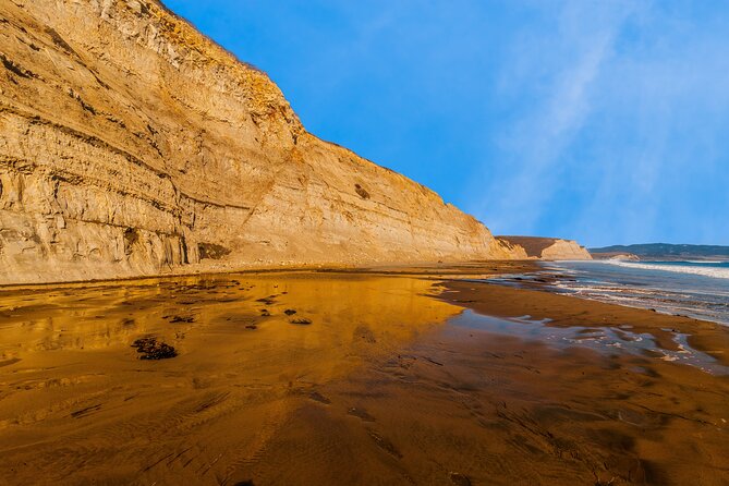
At a fork in the road, you can turn toward Chimney Rock. This detour includes the historic Point Reyes Lifeboat Station, a view toward elephant seals, and a walk to Chimney Rock for ocean views.
The lifeboat station began operating in 1878. Its leader was called the keeper, while the staff were known as surfmen. They patrolled the beaches, watched for wrecks, and listened through fog for people in trouble.
The station saved people from 14 major shipwrecks during its 37 years of operation. That fact gives the stop real weight. Point Reyes was not only beautiful. Its fog, rocky coast, and rough water made it dangerous for ships.
Plan extra time here if you want to walk to Chimney Rock. The audio tells you when to turn, but it cannot replace time on the trail. Wear suitable shoes and keep the walking portion separate from the driving schedule.
Elephant Seals and Sea Lions Are Not the Same
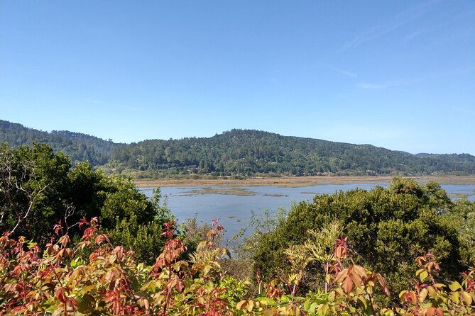
The elephant seal overlook adds a strong wildlife story to the route. Northern elephant seals were hunted for their blubber, and by 1892 only about 75 were left along the entire North American coast.
Protection in Mexico and the United States during the 1920s allowed the population to recover. The first breeding pair returned to Point Reyes in 1981, and the Pacific Coast population is now estimated at around 200,000.
The nearby Sea Lion Overlook gives you another animal comparison. A staircase of 54 steps leads down to a coastal view where sea lions are often gathered.
The audio explains how to tell the animals apart. Sea lions have visible ear flaps and can use their rear flippers to move upright on land. Males can reach about eight feet, while females can reach about six feet.
During the May through August breeding season, males defend territory, call, bark, and fight while fasting on stored blubber. Females have a 12-month gestation period and usually give birth in June or July.
These stops are more than quick animal sightings. The narration gives you a reason to look closely and helps explain why protected areas matter. The overlook includes 54 steps, so keep that in mind if stairs are difficult for you.
The Lighthouse Road and the Best Parking Advice
The tour finishes near the Point Reyes Lighthouse, with the South Beach Overlook appearing first. The lighthouse parking lot is the only dedicated lot for the lighthouse, and it can become congested on weekends.
The practical advice is simple: park when you reach the main lot rather than trying to move closer later. Street parking may be available, but it can also fill up and slow you down.
The tour ends at the Lighthouse Visitor Center at 27000 Sir Francis Drake Boulevard. The stated opening hours are 9 a.m. to 5 p.m., every day, for the listed operating period through February 24, 2027.
The lighthouse itself is not the only reason to make the drive. The route builds toward it by showing you beaches, rescue stations, animal habitat, and working sites along the way. By the time you reach the end, the lighthouse feels like part of a much larger coastal story.
The Leaning Tree and a Small Final Detail
Near the lighthouse road, the narration points out another short cypress tunnel. It leads toward the Leaning Tree, a cypress that bends over the path without appearing ready to fall.
This is a minor stop, but it fits the character of Point Reyes. The peninsula has very few trees, so even a small stand of cypress attracts attention. If you enjoy unusual details and photographs, keep an eye out for it.
The stop also shows why the audio format works here. A sign might not explain why a bent tree matters, but a narrator can point out the feature as you approach.
Is $16.99 Good Value for a Car?
At $16.99 per group of up to four, the cost is low for a two to three-hour route. Split among four people, it costs only a few dollars each. Even with two people, it remains a modest way to add structure and context to a day at the seashore.
The value comes from the combination of directions and storytelling. You get offline maps, automatic audio, a suggested route, and more than 53 stories. You also get lifetime access with no expiry, so you can use it again on another trip.
It is not a replacement for a park pass. Park admission or other required passes are not included, so budget for those separately.
The biggest cost is not money. It is attention. You need to set up the app, keep the phone charged, and listen for route instructions. If you want a person physically present to answer questions, this is not the right format.
Who Will Enjoy This Most?
I would recommend this tour to drivers who like independence but still want a clear plan. It works especially well for couples, families, and small groups sharing one car.
It is also useful if you do not know Point Reyes well. The route connects major stops with less obvious places such as the Cypress Tree Tunnel, KPH Radio station, and Leaning Tree.
You should be comfortable using a smartphone and following GPS directions. If app setup is frustrating for you, ask for help before setting out. Support is available from 5 a.m. to 5 p.m. Eastern time, and the tour includes a tutorial.
The tour is less suitable if you want a short lighthouse-only visit, since the full route includes many optional stops and stories. It is also not ideal if you plan to ignore the suggested direction and drive back and forth, since GPS stories can repeat.
Should You Book This Point Reyes Drive?
Book it if you want to make the drive itself part of the experience. The strongest parts are the stories behind the lifeboat station, the recovery of the elephant seal population, the Cypress Tree Tunnel, and the contrast between the open beaches and protected Drakes Bay.
Skip it if you prefer a live guide or do not want to manage an app. For everyone else, $16.99 per car is a fair price for a flexible route that adds useful context without forcing you into a group schedule.
Download it before leaving strong service, start at Bear Valley, and leave time for the Tomales Point or Drakes Estero detours only if they fit your day. With that preparation, the tour gives Point Reyes more shape, and the famous lighthouse becomes a satisfying final stop rather than the whole reason for coming.
FAQ
Where does the Point Reyes audio tour start?
It starts at 1 Bear Valley Visitor Center Access Road, Point Reyes Station, California.
Where does the tour end?
The tour ends at the Lighthouse Visitor Center, 27000 Sir Francis Drake Boulevard, Inverness, California.
How long does the tour take?
The driving route takes approximately two to three hours. Optional walks, beach visits, photographs, and detours require additional time.
How much does the tour cost?
The price is $16.99 per group of up to four people.
Is a park pass included?
No. Park passes are not included in the tour price.
Does anyone meet you at the starting point?
No. This is a self-guided activity, so you start the app yourself at the designated location.
How do I access the audio tour?
After booking, you receive setup instructions and a password by email and text. Download the separate Action Tour Guide app, enter the password, and download the tour while you have strong Wi-Fi or cellular service.
Does the tour work without cellular service?
Yes. The maps and audio work offline after you download the tour.
Can I use the tour more than once?
Yes. The tour provides lifetime access with no expiry, so you can use it on multiple trips and over multiple days.
Is the tour available in languages other than English?
No. The tour is offered in English only.
Just added around the USA
- Self Guided Driving Audio Tour of Saguaro National Park★ 3.0 · 4 reviews
- Self-Guided Audio Driving Tour of Mount Lemmon★ 5.0 · 4 reviews
- Saguaro National Park Self-Guided Audio Tour★ 3.5 · 11 reviews
- A Self Guided Audio Tour in Tombstone★ 4.0 · 11 reviews
- Catskills Scenic Byway Self-Guided Driving Audio Tour★ 4.0 · 9 reviews
- Big Bend National Park Self Guided Audio Tour Guide★ 5.0 · 12 reviews
- Self-Guided Audio Driving Tour in Catskills Scenic Byway★ 4.5 · 7 reviews
- Shiloh Battlefield Self-Guided Driving Audio Tour★ 4.0 · 9 reviews
Driving Audio Tours, compared.



Ultimate Acadia National Park Self-Guided Driving Audio Tour
Read our review →



Browse the lists this tour appears in